Murodo handles around one million visitors a year, and somewhere between 30 and 40 per cent of them in the spring weeks are tour groups from Taiwan, Korea, Thailand, Singapore, and Malaysia. They come for one thing: a wall of compacted snow, between 14 and 20 metres tall, that the snowplough crews have spent three months carving out of the road. The Tateyama-Kurobe Alpine Route is built around that wall, but the route is much more than the wall. It’s a 37.2km transport chain across the Northern Alps that puts you on a cable car, a highland bus, an electric tunnel bus, a single-span ropeway, an underground cable car, your own two feet across the tallest dam in Japan, and finally a second tunnel bus, all in one day.
I’ll cover the nine transit stages first, then go through each major stop in detail (Murodo, Daikanbo, Kurobe Dam), then handle the practical questions: which direction to run it in, when to come, how to book, what to wear, where to stay. If you’re putting this into a wider trip, see the itineraries piece and the access guide. Murodo sits at 2,450m and a few people get ill at that altitude (it’s a real thing, not paranoia), so the altitude sickness guide is worth a read before you go up.
In This Article
- The nine stages of the route
- The Tateyama Cable Car (Stage 2)
- Bijodaira and the Bijo-sugi cedars
- The Tateyama Highland Bus and Yuki-no-Otani (Stage 3)
- Yuki-no-Otani: the snow corridor
- The plough that built the wall
- Midagahara: the wetland the bus stops at
- Murodo: the high point
- Mikuriga-ike: Japan’s highest crater lake
- Jigokudani and the volcanic vents
- Hiking from Murodo
- Weather, gear, and the altitude part
- The tunnel bus, ropeway, and Daikanbo (Stages 4 and 5)
- The Tateyama Tunnel Electric Bus
- Daikanbo Station and the rooftop deck
- The Tateyama Ropeway: 1.7km without a pillar
- Kurobedaira Station and the Kurobe Cable Car
- Kurobe Dam: the construction of a generation
- The summer water release
- What’s at Kurobeko Station
- Inside the Visitor Centre and the Kurobe Dam Curry
- The Kanden Tunnel and Ogizawa (Stage 8)
- Ogizawa: the eastern gateway
- West-to-east or east-to-west: which direction?
- West to east, starting in Toyama
- East to west, starting in Omachi
- When to come
- Late April to early May: Yuki-no-Otani peak
- Late May to mid-June: spring shoulder
- Mid-June to mid-September: summer
- Mid-September to late October: autumn colour
- Late October to end November: late autumn
- Booking, pricing, and the two ticket systems
- The web-ticket (alpine-route.com)
- The package tour (Hatobus, JTB, Hankyu, Yomiuri)
- Luggage forwarding (Yamato)
- Altitude, weather, and what to bring
- Layers, by season
- The altitude question
- What’s worth bringing
- Where to stay (along the route and at each end)
- On-route lodging at Murodo (2,450m)
- Western base: Toyama and Tateyama
- Eastern base: Omachi Onsen-go
- What the Alpine Route is not
- Combine it with
The nine stages of the route
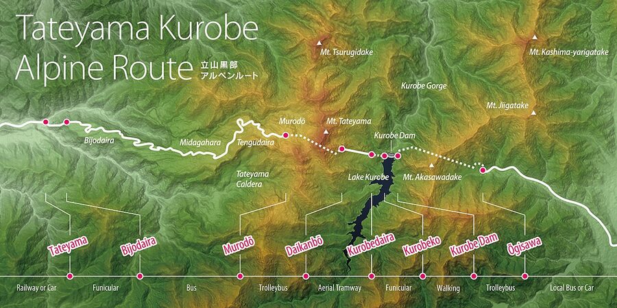
The route runs 37.2km between Tateyama Station in Toyama Prefecture at 475m and Ogizawa Station in Omachi at 1,433m. Going west to east is the standard direction (this is how the operator’s literature is structured and how the snow corridor is set up for spring visitors), so I’ll list the stages that way. Total moving time without queues is just under two hours; with queues at peak season it’s seven to eight.
- 1. Toyama (Dentetsu Toyama) to Tateyama Station. Toyama Chiho Railway, 1 hour, ¥1,420. A local two-car train through rice paddies and the Joganji river valley. Not part of the through-ticket; you buy this separately at the Dentetsu Toyama platform next to JR Toyama.
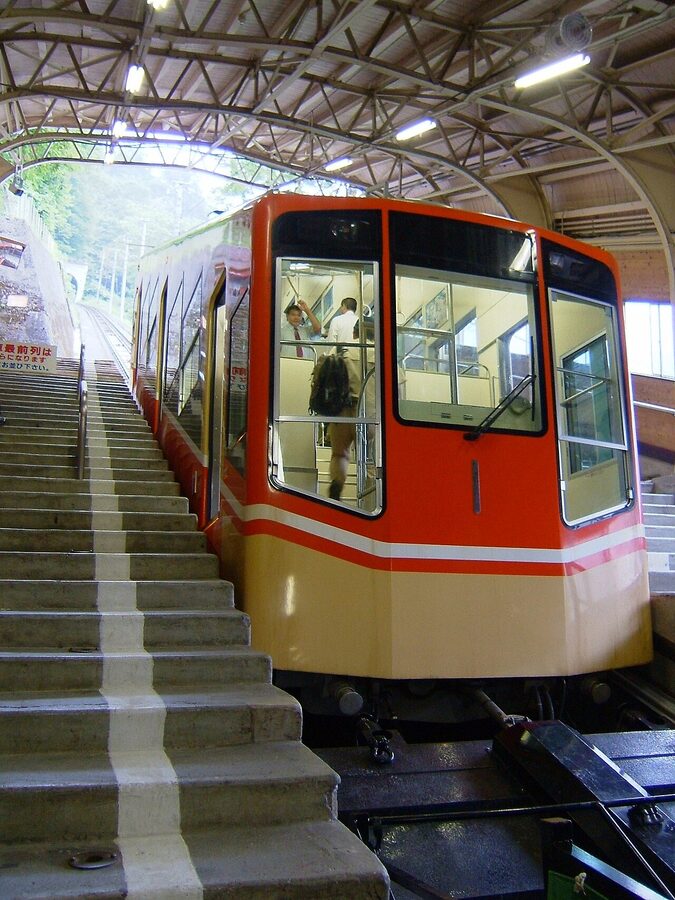
- 2. Tateyama (475m) to Bijodaira (977m). Tateyama Cable Car (立山ケーブルカー), 7 minutes, ¥1,090. A 1.3km funicular on a 29-degree gradient through two short tunnels.
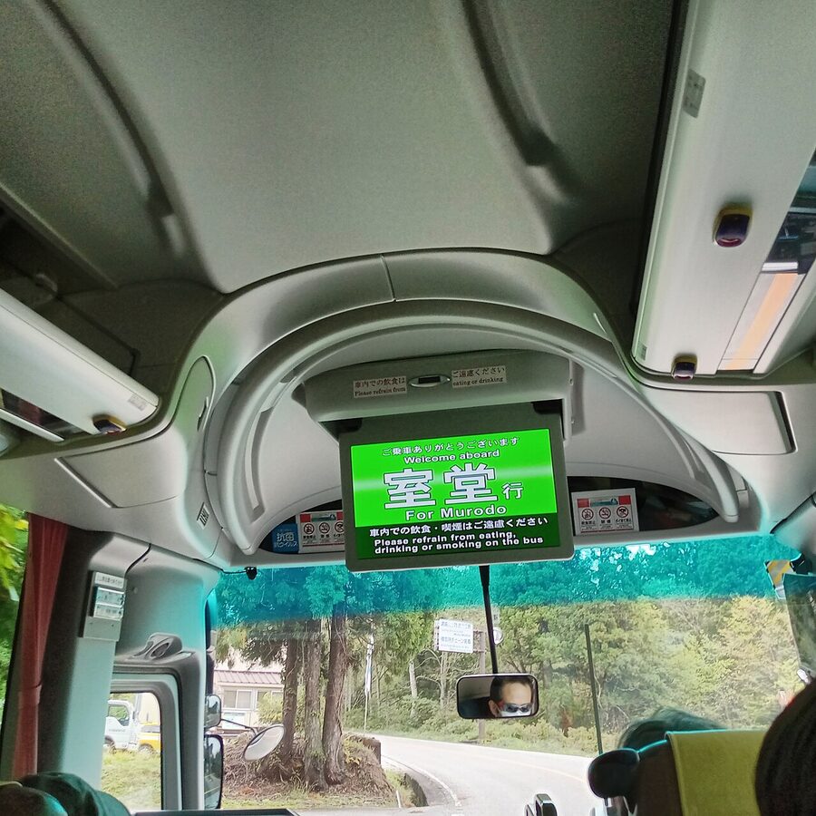
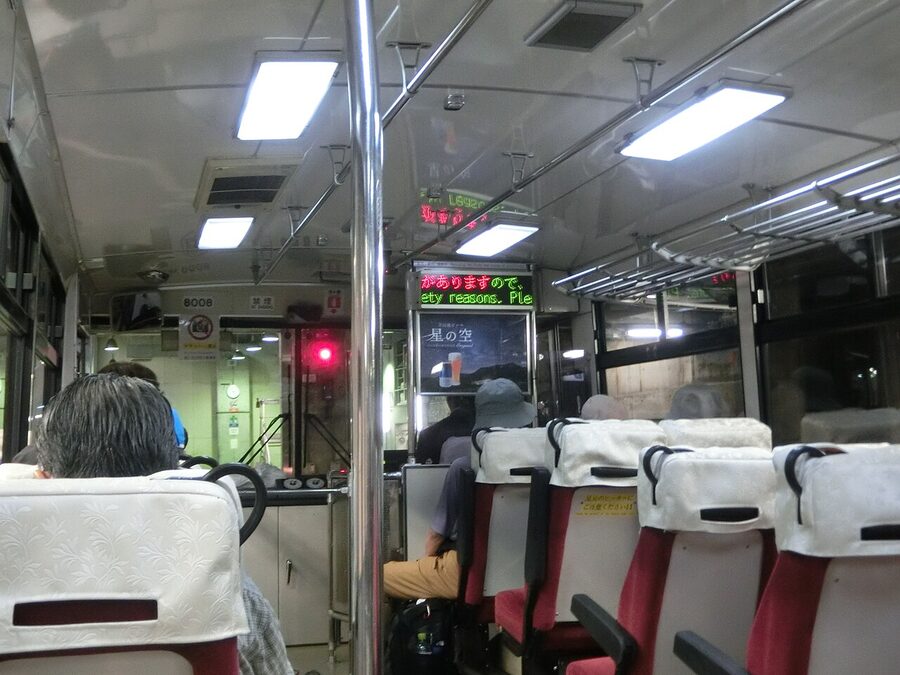
- 3. Bijodaira to Murodo (2,450m). Tateyama Highland Bus (立山高原バス), 50 minutes, ¥3,000. A 23km road climb on the Tateyama Toll Road, no cars allowed since 1974, with the Yuki-no-Otani snow corridor for spring visitors.
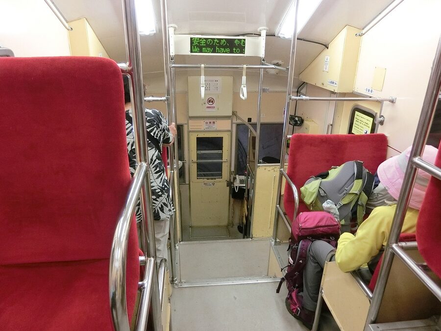
- 4. Murodo to Daikanbo (2,316m). Tateyama Tunnel Electric Bus (立山トンネル電気バス), 10 minutes, ¥2,200. A 3.7km tunnel directly under Mount Tateyama. Replaced the trolleybus in April 2024.
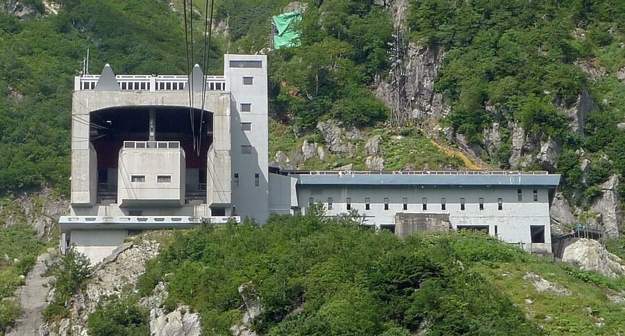
- 5. Daikanbo to Kurobedaira (1,828m). Tateyama Ropeway (立山ロープウェイ), 7 minutes, ¥1,700. 1.7km of cable and not a single support tower in between.
- 6. Kurobedaira to Kurobeko (1,455m). Kurobe Cable Car, 5 minutes, ¥1,150. The whole 800m run is underground.
- 7. Kurobeko to Kurobe Dam. 600m on foot across the dam crest, 15 minutes if you walk straight, an hour if you stop. Free.
- 8. Kurobe Dam to Ogizawa (1,433m). Kanden Tunnel Electric Bus (関電トンネル電気バス), 16 minutes, ¥1,800. 6.1km tunnel drilled by Kansai Electric in the 1950s for dam construction; opened to the public after the dam was finished.
- 9. Ogizawa to Shinano-Omachi. Alpico Bus, 40 minutes, ¥1,650. Onward by JR Oito Line to Matsumoto (50 minutes, ¥1,170) or direct bus to Nagano (105 minutes, ¥4,300).
The through-ticket from Tateyama Station to Ogizawa is ¥10,790 one-way (covers stages 2 to 8). Round-trip tickets exist but almost nobody does them, because the point of the route is to come out the other side. Add ¥1,420 + ¥1,650 if you want station-to-station from Toyama to Shinano-Omachi.
The Tateyama Cable Car (Stage 2)
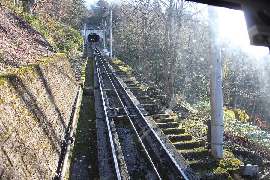
The first vehicle of any consequence. It’s been running since 1954, and the boxy two-car set looks it. The 500m climb takes seven minutes, with two tunnels and ear-pop territory in the middle. You buy this segment with a specific departure time on the through-ticket; the operator will not let you on a different cable car. If your reserved time has passed because of late connections, queue at the staffed counter and the staff will rebook you onto the next available departure free of charge.
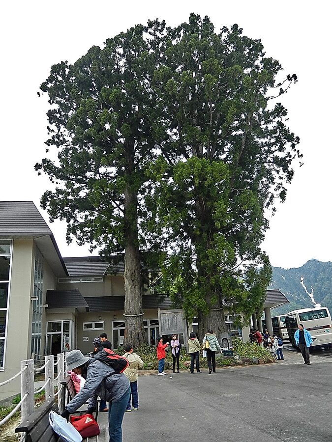
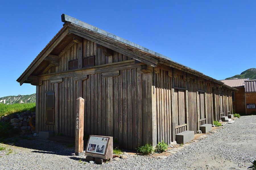
Bijodaira and the Bijo-sugi cedars
Bijodaira itself is a small concrete station, a souvenir shop, and a set of toilets. Most people are off the cable car, onto the bus, and gone in fifteen minutes. The reason to linger is the Bijo-sugi, a 450-year-old Cryptomeria japonica grove behind the station with one tree (the headline Bijo-sugi) at 7m circumference. The 30-minute loop trail is paved, mostly flat, and is the easiest piece of true old-growth forest you’ll walk in this country.
The Tateyama Highland Bus and Yuki-no-Otani (Stage 3)
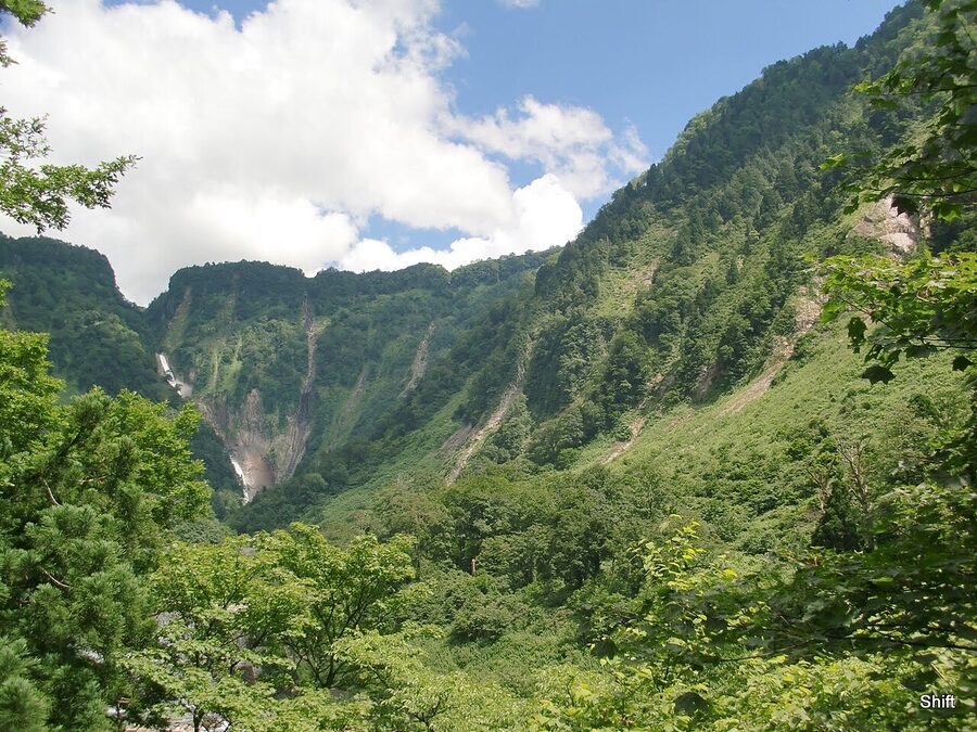
The single best part of the whole crossing for views. The 50-minute climb takes you up the Tateyama Toll Road, which is the route’s vertical workhorse: 23km of road, 1,473 vertical metres, and four climate zones in less than an hour. You start in cedar, move through birch around 1,500m, then pine around 2,000m, then bare alpine meadow above the treeline. Buses run every 30 minutes in low season and back-to-back during Golden Week.
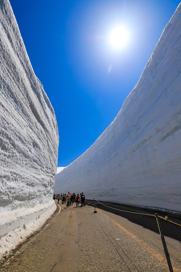
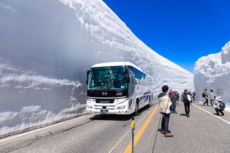
Yuki-no-Otani: the snow corridor
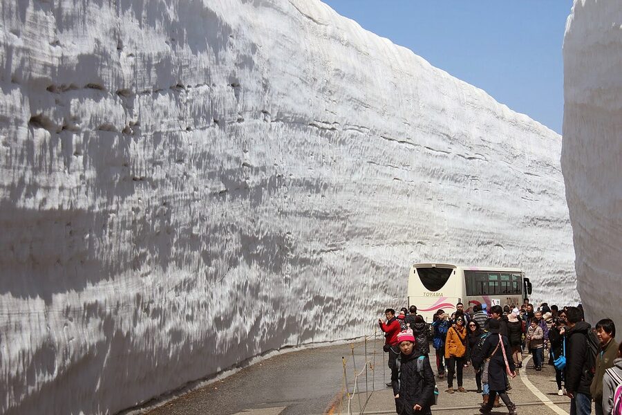
The Yuki-no-Otani (雪の大谷, “great snow valley”) is the headline. From late March each year, a fleet of specialised ploughs led by a GPS-guided unit nicknamed Tateyama Kumataro carves a road clear through compacted snow that has settled and reset over the winter. The result is a 500m walking section along the Toll Road with snow walls 14 to 20 metres high on either side. The all-time record was 20m+ in 2003. The 2013 to 2022 ten-year average is 16m+. In 2026 the snow walk is open from 15 April to 25 June, daily 9:30 to 15:00.
The plough that built the wall
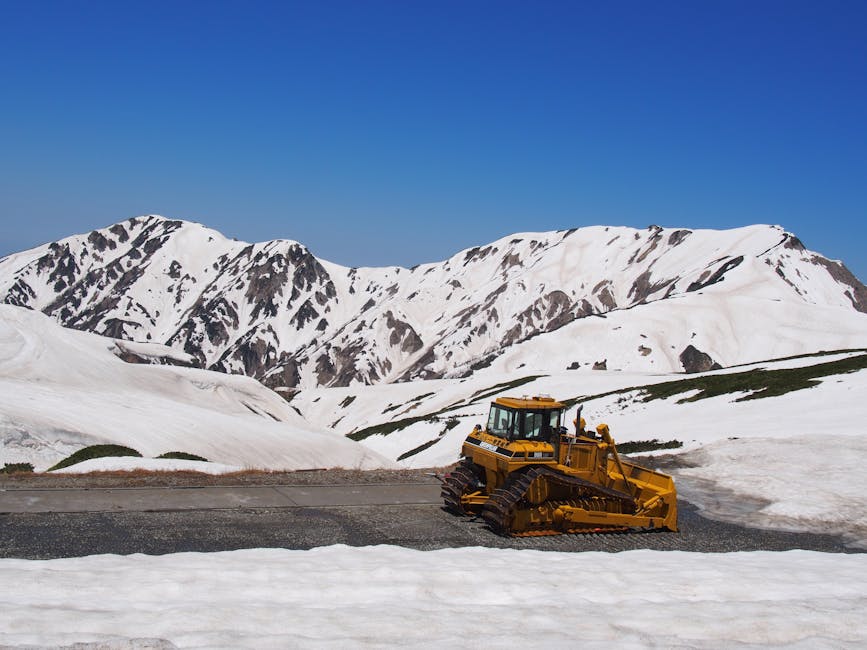
The wall isn’t a freak natural feature. It’s the side-effect of the snowplough crews carving a single lane through where the buried road runs, and the road happens to run along the lee slope of Mount Kunimi where wind drifts dump four months of accumulated snow. By the time the crews start in mid-March, the depth at the worst spots is somewhere between 16 and 20 metres. They cut down to the asphalt and leave the walls vertical. Wall heights drop steadily through May and June: peak around 1 May (typically 16 to 18m), about 10m by the end of May, 5 to 6m by mid-June, and the corridor closes when the walls get below safe height.
Midagahara: the wetland the bus stops at
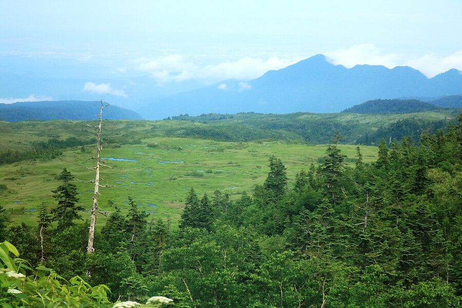
Above 1,800m the road levels onto Midagahara (弥陀ヶ原), a protected wetland recognised under the Ramsar Convention. From late June the boardwalk turns into a carpet of cottongrass; July and August get the alpine wildflowers (you’ll see chinguruma, tsugazakura, alpine buttercups). The Highland Bus stops at the Midagahara bus stop for 20 minutes on most summer departures, which is just enough time to walk the easy 30-minute boardwalk loop. In spring, the whole area is buried under five to seven metres of snow and the bus blows straight past.
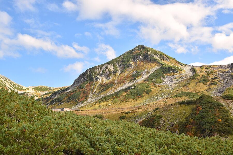
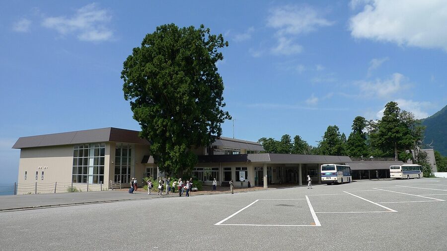
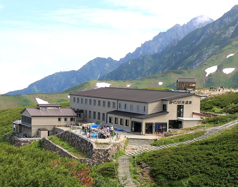
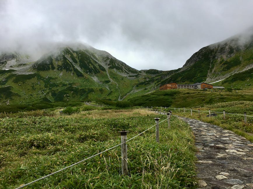
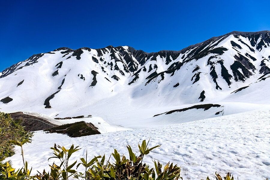
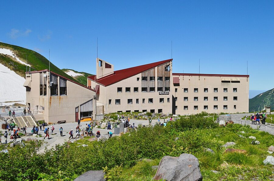
Murodo: the high point
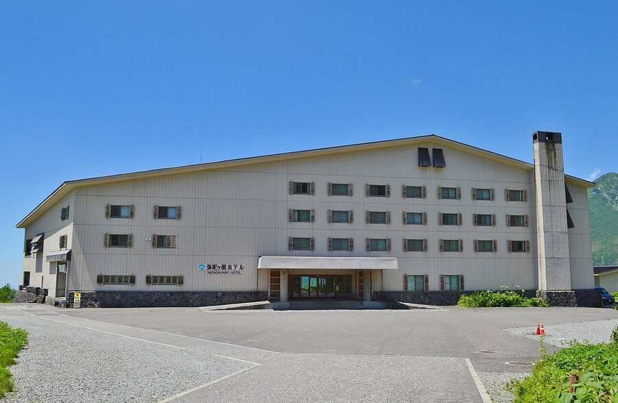
Murodo at 2,450m is where the route earns its existence. It’s the highest road-accessible point in Japan, and where most route visitors spend three or four hours: more if they’re hiking, less if they’re catching the next ropeway. The terminal is a three-storey concrete block with a visitor centre, three restaurants, an observation deck, the connecting tunnel-bus platform, and Hotel Tateyama (more on that in the lodging section). Outside, paved paths fan out across the plateau towards Mikuriga-ike, Jigokudani, and Raicho-zawa.
Mikuriga-ike: Japan’s highest crater lake
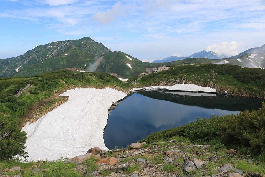
15 minutes from the terminal on the paved trail. It’s a small lake, maybe 350m around, but the water is famously still and on a windless morning Tateyama’s three peaks reflect in it cleanly. Right next to the pond sits Mikurigaike Onsen, the highest hot-spring inn in Japan at 2,410m, which is a major draw for the onsen circuit. You can stay here (read the lodging section) or just buy a day-bath at ¥800 between 09:00 and 16:00, towel rental ¥200 extra. The water is sulphurous and milky, sourced from the Jigokudani vents 100m below.
Jigokudani and the volcanic vents
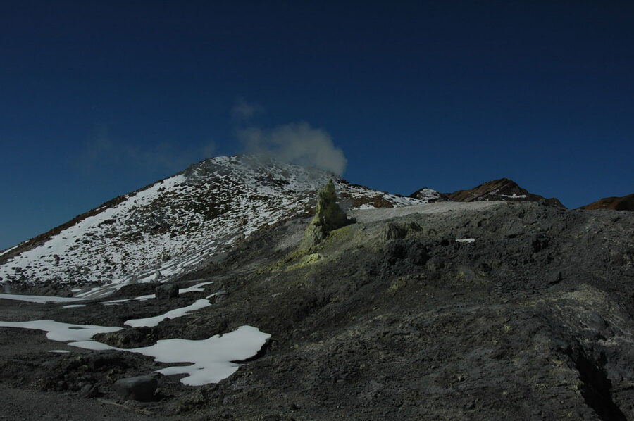
Jigokudani (地獄谷, “Hell Valley”) is the active fumarole field below Murodo. It’s the source of the onsen water and also the reason the trail down into it gets closed when hydrogen sulphide concentrations spike. From the lookout above, the steam plumes are constant; the trail to the valley floor is restricted, and people with respiratory conditions should look from the rim only. Even at the rim the smell is enough to turn the stomach if the wind is wrong. The volcanic activity is what fuels every onsen on this side of the mountain, all the way down to the Tatemiyama and Tateyama-machi bath complexes back at 475m.
Hiking from Murodo
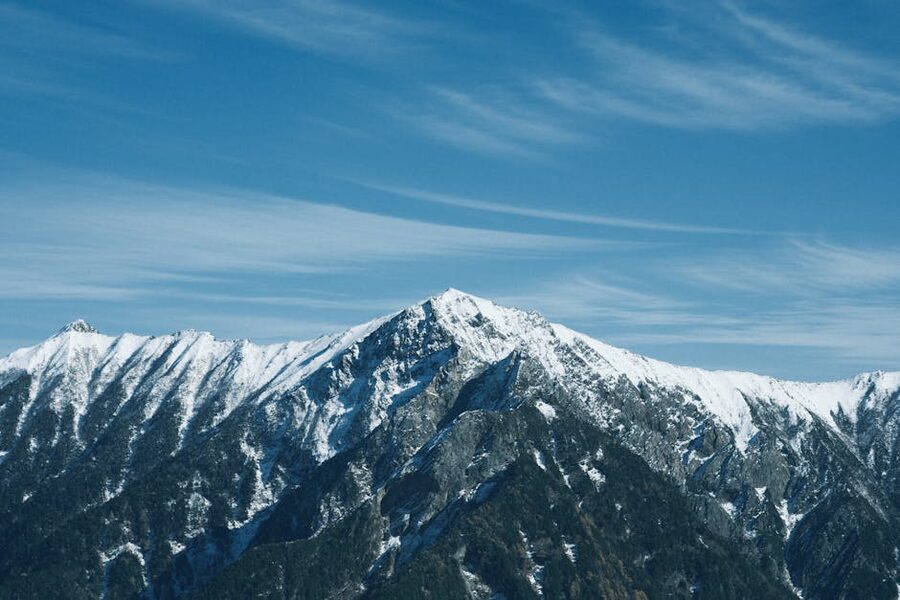
If you’re a competent walker, the route is a launch pad for some of the best half-day and full-day hiking in central Honshu. The Murodo loop is two flat hours and covers Mikuriga-ike, Raicho-zawa, and the Jigokudani lookout. Push on and you can climb Oyama, the easiest of Tateyama’s three summits, in three hours up and two down (885m vertical gain, scrambly final 15 minutes, summit shrine, Yusen-jinja, sells charms). Cross the ridge to Onanji-yama and Fuji-no-Oritate and you’ve climbed all three. None of this needs technical kit; trail shoes and a wind layer are enough on a settled summer day.
Weather, gear, and the altitude part
Murodo is not Toyama-plain weather. Summer daytime averages 10 to 15°C; spring and autumn run below freezing on cold mornings; April and May are full winter with metre-deep snow underfoot, and a Toyama 25°C day at sea level easily means a Murodo 5°C with wind and snow underfoot. People turn up in shorts and sandals every season. Bring a proper layer (windproof shell minimum), trousers, closed shoes. The visitor centre sells emergency layers but they cost double what you’d pay in town.
Around three per cent of visitors notice altitude symptoms at Murodo: light-headedness, mild headache, occasionally nausea. It’s not paranoia; 2,450m is high enough that fit people from sea level can feel it, especially in the first hour after the bus disgorges them. The fix is the same as on any altitude day: hydrate, slow down, don’t sprint up Oyama on the same day you arrived from Toyama. If you have an existing heart condition or you’re in your first trimester, talk to your doctor before you book. The dedicated altitude guide covers the symptoms and the route-specific timing.
The tunnel bus, ropeway, and Daikanbo (Stages 4 and 5)
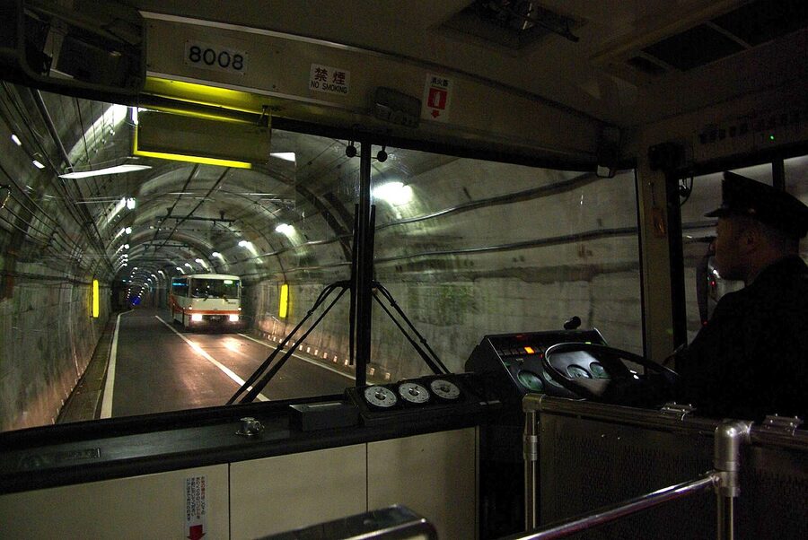
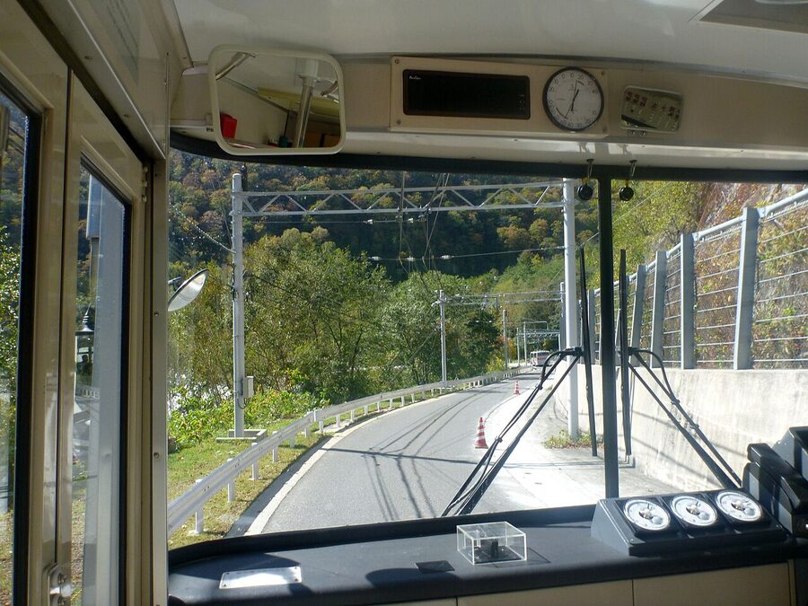
The Tateyama Tunnel Electric Bus
The 3.7km tunnel under Mount Tateyama runs at around 5°C year-round, takes 10 minutes, and used to be the Tateyama Tunnel Trolleybus, the last operating trolleybus line in Japan. Replaced by battery-electric buses in April 2024. Same route, same fare (¥2,200), no overhead wires. The tunnel includes a passing-place at the midpoint where two buses meet head-to-head and crawl past each other; the lights flick on the wall to show which side has priority. Watch for it.
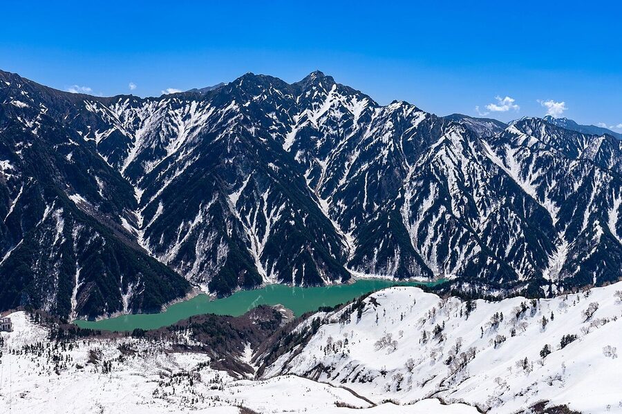
Daikanbo Station and the rooftop deck
Daikanbo at 2,316m is a transfer station with one piece of magic: a free rooftop observatory, accessed by a flight of stairs from the platform level. From the deck the view runs across Lake Kurobe to the Ushikubidake ridge, with the Akaishi range visible to the south on a clear day. There is no other deck on the route at this elevation with this combination of lake-and-peaks geometry. If queues are bad downstairs (the ropeway is the route’s worst bottleneck, see below), the rooftop is where to wait it out. There’s a cafe at platform level selling coffee and a passable curry rice for ¥1,200.
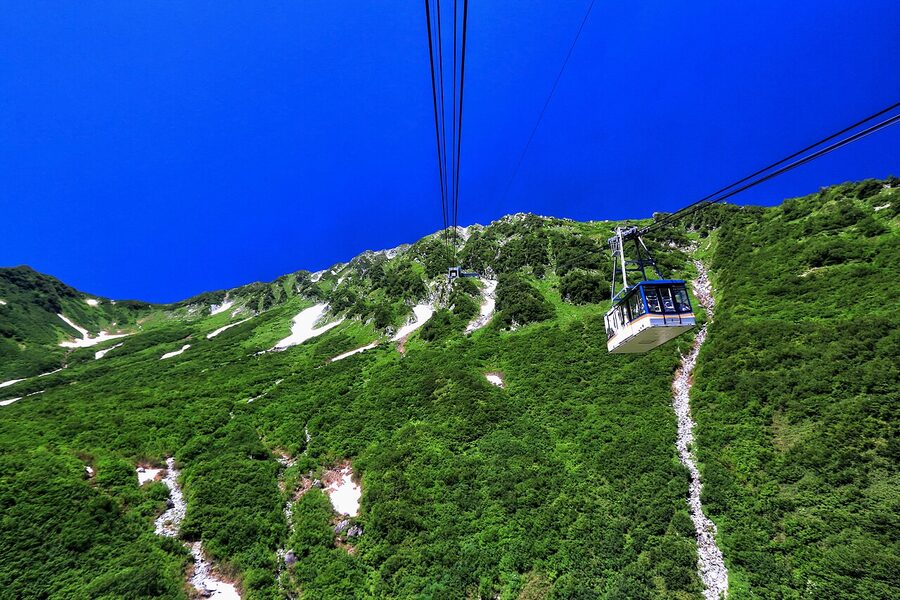
The Tateyama Ropeway: 1.7km without a pillar
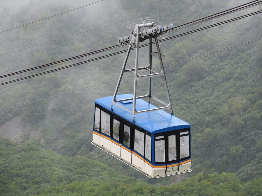
Two cabins, one cable, no pillars in the middle. The ropeway is the route’s single biggest bottleneck because each cabin holds 80 people and there’s only one cabin going each way. Capacity is around 480 per hour per direction. On Golden Week you’ll wait 30 to 60 minutes here; reservations cover a seat on the day, not a specific cabin. Departures every 20 minutes during peak. The ride itself takes 7 minutes and on a clear day is the most photographed segment of the route.
Kurobedaira Station and the Kurobe Cable Car
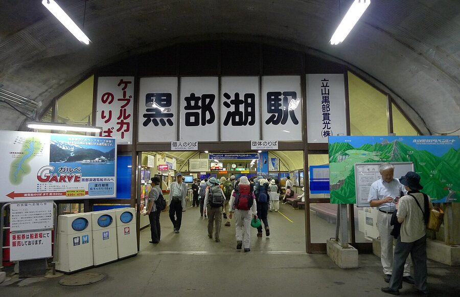
Kurobedaira at 1,828m is a quick transfer point: 20-minute scheduled stop on most through-tickets, a souvenir shop, a small viewing terrace, and the entrance to the Kurobe Cable Car platform. The cable car itself runs entirely inside a tunnel from Kurobedaira to Kurobeko, descending 373m in 5 minutes. It’s the only cable car in Japan that runs underground its full length, dug that way to protect the cars from rockfall during winter. You don’t see the lake during this segment; the descent is dark.
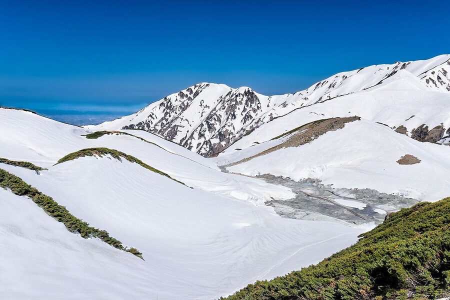
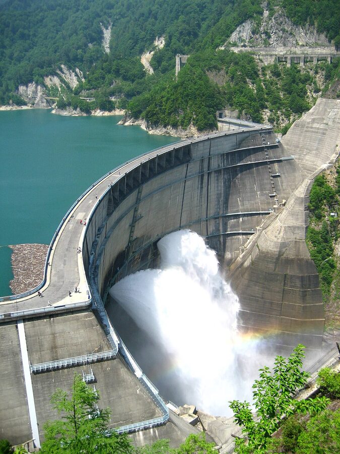
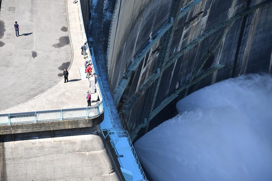
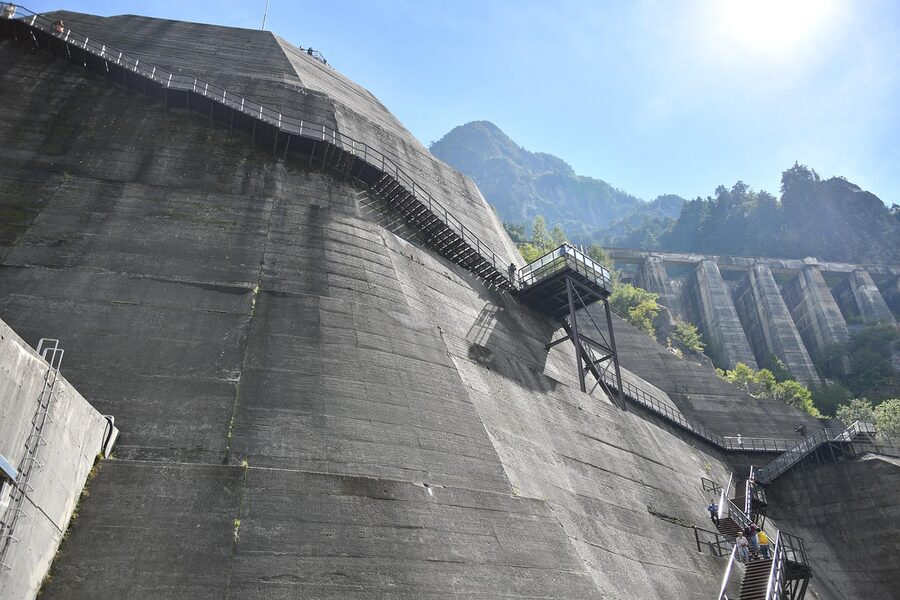
Kurobe Dam: the construction of a generation
This is both a transit point and the single biggest destination on the route. Kurobe Dam is a concrete arch dam 186m tall and 492m wide, holding back the headwaters of the Kurobe river to feed the Kurobe No. 4 hydroelectric plant downstream. Construction ran from 1956 to 1963 in conditions remembered as some of the worst on any Japanese civil-engineering project: 171 workers died in the seven years of building, mainly in the Kanden Tunnel and the canyon excavation. Walk from Kurobeko along the lake shore for ten minutes, then along the dam crest itself, then into the Kanden Tunnel on the eastern side. Budget at least 60 minutes here, ideally 90.
The summer water release
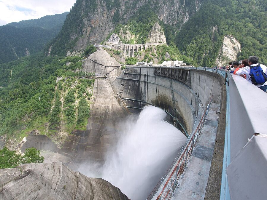
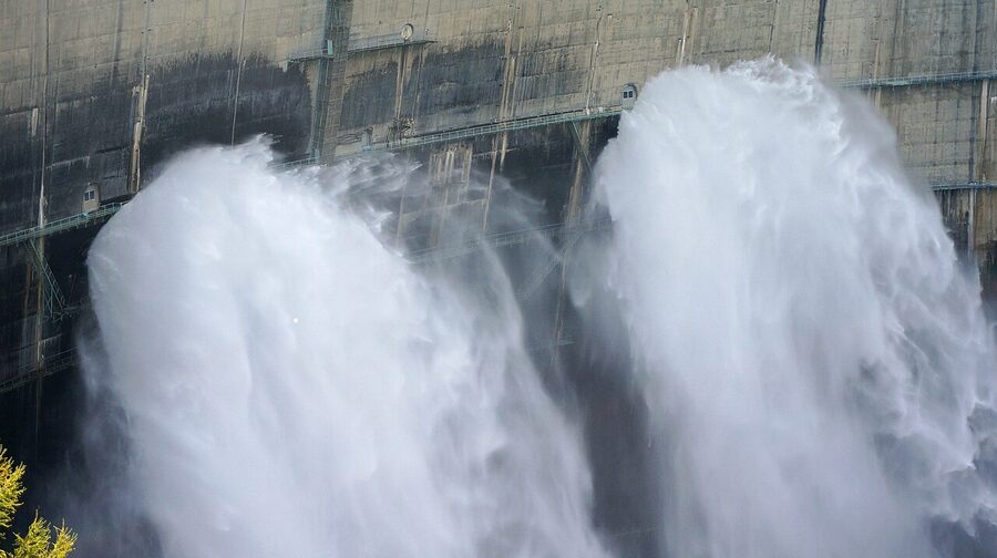
Between 26 June and 15 October the dam puts on the headline show: a controlled release of 10 to 15 cubic metres per second from the central outflow gates, which throws a 100m vertical plume of mist into the canyon. The spray reaches the south-side observation deck regardless of the wind and you should expect to get damp. Times are roughly 06:00 to 17:00 in midsummer, shorter in shoulder months. Check the dam’s official site for the day’s schedule before you commit your timing; off-discharge days are rare but possible.
What’s at Kurobeko Station
The Kurobeko side has a small terminal, a souvenir shop, and a footpath down to the lake-level boat dock. The Lake Kurobe Sightseeing Boat (Garube) runs from late May to mid-November, 30-minute cruises at ¥1,200, every hour on the half-hour. From the boat you see the dam from below: 186m of curved concrete, with the discharge plume to one side. It’s the only way to photograph the dam from this angle without a helicopter. Add at least 90 minutes to your route timings if you want to do this.
Inside the Visitor Centre and the Kurobe Dam Curry
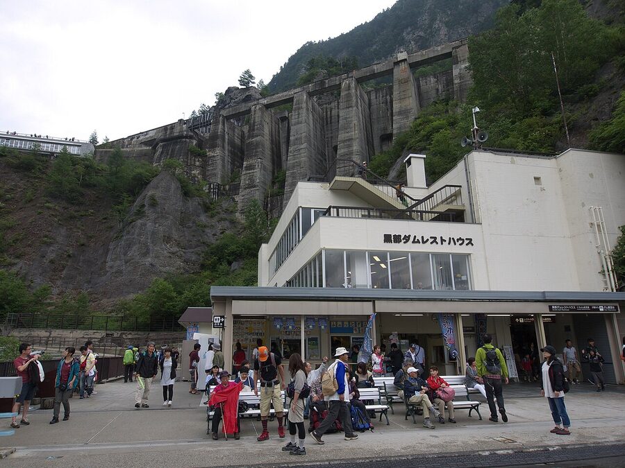
On the east side of the crest, the dam complex includes the Visitor Centre with its Black Diamond Road documentary (25 minutes, on rotation every half-hour, free, English subtitles available), an outdoor stele commemorating the 171 dead, and the restaurant block. The Visitor Centre’s headline souvenir is the famous Kurobe Dam Curry at ¥1,300: a curved rice “wall” shaped like the dam, with a crisp chicken-cutlet “tour bus” on top and green-curry water for the lake. Most route visitors skip lunch elsewhere and eat here for the gimmick, which is fine.
The Kanden Tunnel and Ogizawa (Stage 8)
The Kanden Tunnel is the route’s other tunnel, 6.1km long, drilled by Kansai Electric in the late 1950s as the construction access road for Kurobe Dam. Took two and a half years to dig. After the dam opened in 1963 the tunnel was repurposed as a public road. Trolleybuses ran here until April 2018, when Kansai retired the overhead and switched to battery-electric. The 16-minute crossing is unremarkable except for one thing: midway, the bus passes a small marker plaque on the wall commemorating the worst of the Kurobe construction casualties, a fault zone called the Hasaitai (破砕帯) where 30 men died in a single seven-month effort to bore through wet rubble. The driver doesn’t slow down for it; if you want to see it, sit on the right.
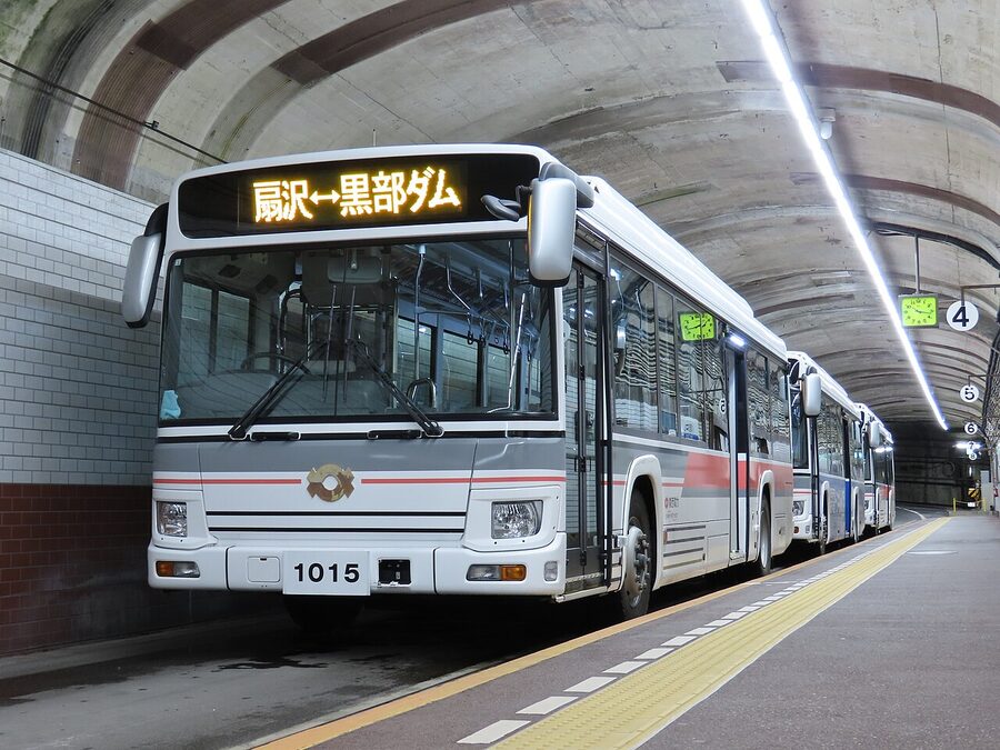
Ogizawa: the eastern gateway
Ogizawa at 1,433m is the route’s eastern terminus and a single-purpose transit station: tickets, toilets, vending machines, an Alpico bus stop, a Yamato Transport luggage counter, and a small souvenir shop. There’s no reason to linger. The Alpico bus to Shinano-Omachi runs every 30 to 60 minutes depending on connecting Kanden bus arrivals; from Shinano-Omachi the JR Oito Line gets you to Matsumoto in 50 minutes. There are also direct express buses to Nagano City (105 minutes, ¥4,300) for travellers continuing east. Some hotels in Omachi Onsen-go run free pickup shuttles from Ogizawa if you book ahead.
West-to-east or east-to-west: which direction?
Both directions cost the same and take the same time. The differences are about light, queues, and where you sleep at each end.
West to east, starting in Toyama
- Earliest start at 06:30 from Toyama on the Chiho Railway, first cable-car at 08:00, Murodo by 09:30 if connections are clean.
- Snow corridor and Murodo views are best in late morning when the light is full on the wall.
- You hit the Daikanbo ropeway around midday, the busiest queue moment.
- Kurobe Dam mid-afternoon, late afternoon Ogizawa, Matsumoto by dinner.
- Best for: Yuki-no-Otani photography, finishing in Omachi Onsen for the post-route soak.
East to west, starting in Omachi
- First Alpico bus to Ogizawa from Shinano-Omachi at 06:30, Kanden Tunnel bus at 07:00, Kurobe Dam by 07:20.
- You see Kurobe Dam in the morning calm before the day-trip coaches arrive (genuinely the case; the boats run after 09:00 anyway).
- Murodo around 11:30 to 12:30; Yuki-no-Otani in flatter midday light, but with the morning crowds already moving the other way.
- Tateyama side in early afternoon, Toyama by 16:00. Bay sushi for dinner is well-earned.
- Best for: people continuing to Kanazawa or the Hokuriku coast.
I’d run it west to east 9 times out of 10. The light hits the snow corridor better, you finish at a quiet station with onsen options, and the Hotel Tateyama overnight is easier to book if you go up rather than down to it. East to west is the right call only if your wider trip flows that way (e.g. Tokyo overnight to Matsumoto, then westward into Toyama and Kanazawa).
When to come
The route’s calendar is fixed and short. Opening day: 15 April every year. Closing day: 30 November (the date varies by a week depending on snowfall). Closed entirely from 1 December to 14 April: that’s nineteen weeks of the year with the route shut, longer than it’s open at full schedule.
Late April to early May: Yuki-no-Otani peak
Snow walls at maximum, all the routes lit up bright white. Golden Week (29 April to 5 May) is the worst possible week for crowds: every bus, ropeway, and tunnel runs full, queues at Daikanbo can hit 60 minutes, and the snow corridor itself fills up by 10:00. Weekday visits in the last week of April are the genuine sweet spot: walls still 16 metres, no Golden Week crush, but reservations still firmly required.
Late May to mid-June: spring shoulder
The walls drop from 14m to about 6m across these four weeks, but they’re still substantial and the queues are a third of Golden Week levels. By mid-June the corridor closes when the walls get below safe height. Budget travellers and photographers willing to swap headline-height for empty paths should aim for this window.
Mid-June to mid-September: summer
The full schedule runs, the Highland Bus stops at Midagahara, wildflowers cover the wetlands, and Murodo offers actual hiking weather (10 to 15°C daytime, low single digits at night). Obon (13 to 16 August) is a domestic-tourist peak; weekday-Tuesdays through Fridays in late June or early September are the calmest in the season. The dam’s discharge runs from 26 June.
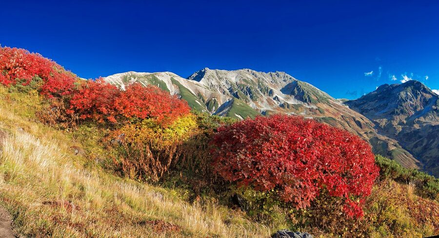
Mid-September to late October: autumn colour
The second peak of the year, and many regulars consider it the best window full stop. Larch and birch turn gold; Murodo is a palette of reds, golds, and dark conifers; the dam catches the colour from the upper canyon walls. Weekend queues match Golden Week levels but weekdays are still calm. Cool nights, frequent fog mornings on the lake at Kurobedaira. By 30 October the Murodo larch is bare and the snow has started.
Late October to end November: late autumn
Lake Kurobe is drained ahead of winter (the level drops 30m over October to give the dam capacity for the snowmelt runoff), the Tateyama side gets early snow, and crowds thin to almost nothing midweek. The last three weeks of the season are often the best combination of late autumn colour, low traffic, and atmospheric weather. Bring proper layers and check the closing-date forecast on the route website weekly: the route can shut early if snow gets ahead of the ploughs.
Booking, pricing, and the two ticket systems
There are two booking systems and they confuse first-time visitors more than they should.
The web-ticket (alpine-route.com)
The official online booking is the WEB Ticket on the operator’s site (tateyama-kurobe-webservice.jp). You pick a date and a starting time at either Tateyama Station or Ogizawa Station, and the system books your cable car or first tunnel bus for that exact slot. The other six segments are then guaranteed in sequence, with timed entry only at the cable cars. You pay in advance, present a QR code at the gate, walk through. The through-ticket from Tateyama to Ogizawa is ¥10,790 one-way on the WEB Ticket, identical to the at-station price.
Web booking opens roughly a month before each travel date, around the 5th of the previous month. Golden Week dates and the first weekend of October sell out within hours of release; weekday bookings outside peak periods almost always survive until a week before. If you can plan to a date, book the WEB Ticket and don’t queue. If you can’t, buy at the Tateyama or Ogizawa station counter on arrival; tickets are not capped (the cable car is the only sub-segment that uses time slots), but you’ll wait an extra 30 to 60 minutes at the cable-car gate during peak periods.
The package tour (Hatobus, JTB, Hankyu, Yomiuri)
The other system is the all-in coach tour from a major Japanese travel operator. Hatobus, JTB Sunrise Tours, Hankyu Travel, and Yomiuri Travel all run two-day and three-day spring packages: bus pickup in Tokyo or Osaka, accommodation pre-booked at Toyama or Omachi, the route ticket included, and a guide on board. Prices range from ¥38,000 for a basic spring two-day to ¥120,000 for the autumn deluxe with a Hotel Tateyama upgrade. These don’t save money, but they save the booking-coordination headache, and during Golden Week they’re sometimes the only way to get a Hotel Tateyama bed.
Luggage forwarding (Yamato)
Big suitcases don’t fit on most route vehicles; in particular the cable cars cap luggage at 30kg and 130cm combined dimensions. Yamato Transport runs counters at both Tateyama Station and Ogizawa Station: ¥2,000 to ¥2,500 per bag, next-day delivery between your origin hotel (Toyama, Kanazawa, Tokyo) and your destination hotel (Matsumoto, Nagano, anywhere). Drop your bag before 11:00 and it arrives at your destination by 18:00 the next day. The counters open at 07:30. Carry only what you need for the day on the route itself: layers, water, a packed lunch.
Altitude, weather, and what to bring
Layers, by season
- April to early May: winter coat, hat, gloves, waterproof shoes. The snow corridor is full winter conditions, with two to three metres of snow underfoot off the cleared paths.
- Late May to mid-June: heavy fleece + windproof shell, walking shoes, hat. Some snow patches at Murodo into early June.
- Late June to August: long trousers, T-shirt, light fleece, windproof, walking shoes. Bring a waterproof for thunderstorms (afternoon rain is common).
- September to mid-October: as for May, plus a hat. Mornings can be 0°C at Murodo even on warm autumn days at sea level.
- Late October to November: winter gear back to full. Light snow possible from late October.
The altitude question
Murodo at 2,450m is high enough that a small but real fraction of fit visitors notice altitude effects: light-headedness in the first hour, mild headache, mild nausea. The cure is simple. Don’t run. Drink water. Sit down for ten minutes if you feel off. Avoid alcohol on the way up (the ¥1,000 sake at Murodo is fine after you’ve been there an hour). Most people are fine; the vulnerable groups are people in their first trimester of pregnancy, anyone with an existing heart condition, and people who came up from sea level too fast (less common on this route because the bus climb itself takes 50 minutes). The full breakdown is in the altitude sickness guide; read it if you have any concerns.
What’s worth bringing
- 1L water per person, more in summer.
- Packed lunch from a Toyama or Omachi convenience store. Murodo restaurants exist but they’re ¥1,800 for a basic curry rice and queues are 20 minutes at noon.
- Cash. The dam’s curry restaurant takes cards; some smaller stops are cash only, especially the souvenir kiosks.
- A small daypack, not a roller suitcase. Yamato handles the big bag.
- Sunscreen and sunglasses. UV at 2,450m is brutal.
- A spare battery for your phone. Photo opportunities are constant and so are dead phones at Daikanbo.
Where to stay (along the route and at each end)
On-route lodging at Murodo (2,450m)
- Hotel Tateyama (250 rooms, Western-style mostly, attached to Murodo terminal): ¥18,000 to ¥28,000 per person with two meals depending on the room and season. The only conventional hotel at this altitude in Japan. The west-facing rooms get the sunset over Mount Yakushi. Check Hotel Tateyama on Booking.com.
- Mikurigaike Onsen (15-minute walk from the terminal): the highest hot-spring inn in Japan at 2,410m. Shared rooms from ¥13,000 with two meals. The bath alone is ¥800 day-use. Closed in winter; book through the inn’s website (mikuri.com) or via the route operator’s package.
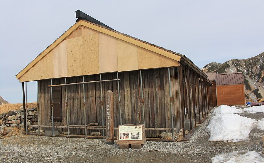
- Murodo Sanso (working mountain hut, 5-minute walk): ¥13,000 to ¥15,000 with two meals. Shared sleeping rooms; family-run since 1726. The cheapest stay at altitude on the route.
- Raichoso (next to the terminal): another working mountain hut, ¥12,000 with two meals, shared rooms. Tend to be the last to sell out.
Western base: Toyama and Tateyama
- Toyama City hotels: a 60-minute Chiho train from Tateyama Station. The JR Toyama hotel cluster (Hotel JAL City Toyama, Toyokuni Inn, Daiwa Roynet) puts you 5 minutes’ walk from the Dentetsu Toyama platform for the morning train to the route. Search Toyama on Booking.com.
- Tateyama Town ryokan: Tateyama Town has a small cluster of family-run ryokan within 10 minutes of Tateyama Station, including Senjuso and Ryusuiso. Useful if you want a 7am cable-car start with no train transfer.
Eastern base: Omachi Onsen-go
- Omachi Onsen-go is the cluster of ryokan in the woods between Ogizawa and Shinano-Omachi, 20 minutes by bus from Ogizawa. Properties to know: Ougi Onsen Ougizawa (closest to Ogizawa, simple ryokan), Ryokan Toko-en (riverside, family-run), Hotel Kuroyon Royale (modernised, Booking.com-listed). All run free shuttles from Ogizawa or Shinano-Omachi if you book ahead.
- The post-route soak: any of the Omachi Onsen-go inns have indoor and outdoor baths; the water is sulphate-bicarbonate and the post-route effect on tired calves is the best thing you can do for them. See the wider onsen guide for the full Tateyama-side circuit.
What the Alpine Route is not
A few things the Alpine Route is regularly mistaken for, and isn’t.
- It’s not a hiking trail. It’s a sequence of vehicles connected by paved walks. You can hike from Murodo (Oyama, the Tateyama traverse) but the route itself is bus-and-cable-car.
- It’s not the Kurobe Gorge Railway. That’s a different excursion further north, autumn-focused, runs along the Kurobe river from Unazuki Onsen, and uses an open-sided tourist train. The Gorge Railway and the Alpine Route share the river, not the access road.
- It’s not the same as Kamikochi. Kamikochi is also high alpine and also bus-access only, but it’s a hiking destination (Hotaka, Yari, the Azusa river); the Alpine Route is a transit chain. Some itineraries do both, two days apart.
- It’s not a way to “save time” between Toyama and Matsumoto. The standard route is 4 hours via the Hokuriku Shinkansen + Tokyo + Chuo Line. The Alpine Route is 7 to 8 hours, costs ¥13,000+ in fares, and is enjoyed for what it is, not for shortcut value.
- It’s not open in winter. Yes, even though the snow corridor is the headline. December to mid-April: closed.
Combine it with
The Alpine Route is the headline of any Japan Alps trip and naturally pairs with several other pieces of the region.
- Toyama Bay sushi the night before or after, see Things to Do in Toyama for the recommended restaurants.
- Kanazawa as the western anchor, 25 minutes by Hokuriku Shinkansen from Toyama. Good for the Kenrokuen and the samurai district.
- Kamikochi as the alpine companion two or three days later, accessed from Matsumoto via the Kama-tunnel bus.
- Takayama for the matsuri (April or October), the morning markets, and the Hida-gyu beef. Combines well with the Alpine Route as a four-day Hokuriku-Hida circuit. The full Takayama cluster is in the old town walk, the festival guide, the food guide, and the where to stay piece.
- Shirakawa-go as the gassho-zukuri detour from Takayama (a 50-minute bus from Takayama, day-trippable).
- Spring skiing at Tateyama in late April or May for advanced skiers; the Highland Bus drops you at Murodo and you skin or hike up Tsurugi-zawa or Oyama for the descents back to the plateau.
- Onsen circuit built around Mikurigaike (highest in Japan), Tatemiyama, Omachi Onsen-go, and Hirayu, all of which can pair with a route day.
- 5, 7 or 10-day Japan Alps itineraries for how the route slots into a wider trip plan.
One last thing on timing. The route operator publishes the snow-wall heights weekly on the official site every Thursday afternoon; the discharge times for Kurobe Dam are also there, day by day. Both are worth checking the week before you go. The wall numbers are reliably honest, and the four ploughs that make the wall (Tateyama Kumataro, Murodo Otaro, plus two unnamed Mitsubishi rotaries) are still working at the height of summer, clearing snowdrift remains from the pulled-back walls. The wall is not a backdrop. It’s the road, and somebody is still building it.
.jpg)
.jpg)
_at_Bijodaira_Station_20110515.jpg)
.jpg)