The first time I rang one of the bear bells above Magome, I felt a bit silly doing it. There was a couple twenty metres ahead of me on the cedar-lined path, the sun was up, the path was wide enough for two abreast, and the only living thing in sight was a black-and-yellow swallowtail working its way along a sasa-bamboo edge. But you ring the bells anyway. They sit on iron posts every few hundred metres above the Magome-toge pass, and the locals who maintain them have left enough hand-painted signs in English, Japanese and (these days) Korean that you understand the etiquette: you ring, the noise rolls down the slope, and if there’s a bear in the next ravine he hears you before you see him. So I rang. The clang carried weirdly far, longer than seemed reasonable. Then the path tilted down through cryptomeria and the bell faded behind me, and I was on the descent into Tsumago.
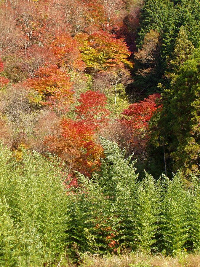
That ten-minute walk down from the pass is what most people picture when they hear “the Nakasendo.” The clue is in the name though. Naka-sen-do: middle-mountain-way. It’s not a footpath. It was one of the five great Edo-period highways, a 540km cross-country route that connected Tokyo to Kyoto over the spine of central Honshu, with 69 official post-towns where palanquins were rested, horses were swapped out, and travelling daimyo and their retinues slept. The whole thing is still walkable in the technical sense. Around 8km of it is properly walkable in the romantic sense. The rest is a mix: some restored, some replanted, some absorbed by Route 19, some still under cobblestone where you wouldn’t expect.
This guide is about how to walk the part that’s actually worth walking, which is the Kiso Valley stretch through the Japan Alps. It’s also about the longer options if you have more days and the obsessive option if you have three weeks. Practical info up front: distances in kilometres, timings in minutes, costs in yen, and named accommodation in each post-town. Skip to the section you need.
In This Article
- What the Nakasendo actually is
- The Kiso Valley: where you actually want to walk
- Magome to Tsumago: the famous 8km
- The walking, beat by beat
- Tsumago itself
- Narai-juku and the Torii Pass: the harder, quieter half-day
- The Torii Pass climb
- Narai itself
- The full Kiso section: 4 to 6 days end-to-end
- Tokyo to Kyoto: the obsessive’s full traverse
- Getting to the trail
- From Tokyo
- From Kyoto
- The local buses
- Luggage forwarding: how to walk light
- Where to sleep along the way
- In Magome
- In Tsumago
- In Kiso-Fukushima
- In Narai
- What to eat in the post-towns
- What to wear and what to bring
- The cobblestone close-up
- When to walk
- Permits, signs, and the practicalities of the walk
- What to combine it with
What the Nakasendo actually is
The Tokugawa shogunate established the Five Routes (gokaido) in the early 1600s. Two of them, the Tokaido along the coast and the Nakasendo through the mountains, both ran between Edo (Tokyo) and the imperial capital of Kyoto. The Tokaido was faster but exposed to typhoons, river floods and storm surges. The Nakasendo was longer (about 526-540km depending on how you measure) but more reliable in bad weather, especially for officials who couldn’t risk the schedule slipping. Princesses travelling between Edo and Kyoto for political marriages were sent down the Nakasendo specifically because it didn’t cross the major rivers that occasionally trapped Tokaido travellers for days.
The road threaded through 69 official shukuba: post-stations roughly a day’s walk apart where travellers could rest, eat, exchange horses and have their travel documents checked. Each post-town had a honjin (the highest-ranking inn, used by daimyo and imperial officials), a wakihonjin (a backup honjin), several hatago (regular inns), and a problem-and-supplies office called the toiyaba. Most also had a kosatsuba, a notice board where shogunal proclamations were posted. Twenty-one of the original notice boards survive somewhere in Japan, and at least three are still in their original locations along the Kiso section.
What makes the Kiso Valley stretch special isn’t that it’s prettier than other sections. It’s that it survived. Between the seven post-towns of Kiso (technically eleven if you count the smaller two), the railway and the modern Route 19 highway run parallel to the old trail along the valley floor, but they don’t sit on top of it. So when the post-towns lost their commercial reason to exist in the late 19th century, the Meiji government dissolved the post-station system in 1872 and the Kiso section was never electrified or widened in the same way as the Tokaido, the buildings just sat there, slowly deteriorating, until preservation movements in the 1960s and 70s caught them in time. If you’re working out where to slot the Nakasendo into a longer itinerary, the day-walk fits between Tokyo and Kyoto without much detour.
The Kiso Valley: where you actually want to walk
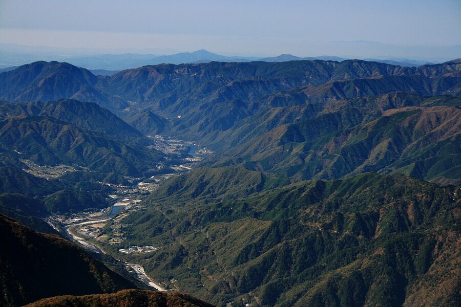
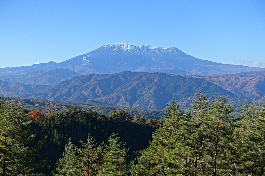
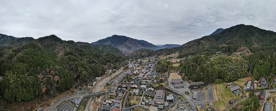
The Kiso Valley is a narrow north-south corridor wedged between the Central Alps and the Kiso Range, watered by the Kiso River, and dominated to the west by Mt. Ontake, Japan’s second-tallest volcano at 3,067m. It’s part of Nagano Prefecture for most of its length, with the southernmost post-town (Magome) just over the border in Gifu. Eleven of the original 69 Nakasendo post-stations sat in this valley, and the seven main ones, Magome, Tsumago, Nojiri, Suhara, Agematsu, Kiso-Fukushima and Yabuhara, were the wealthier stops because they handled both the daimyo traffic and the timber trade.
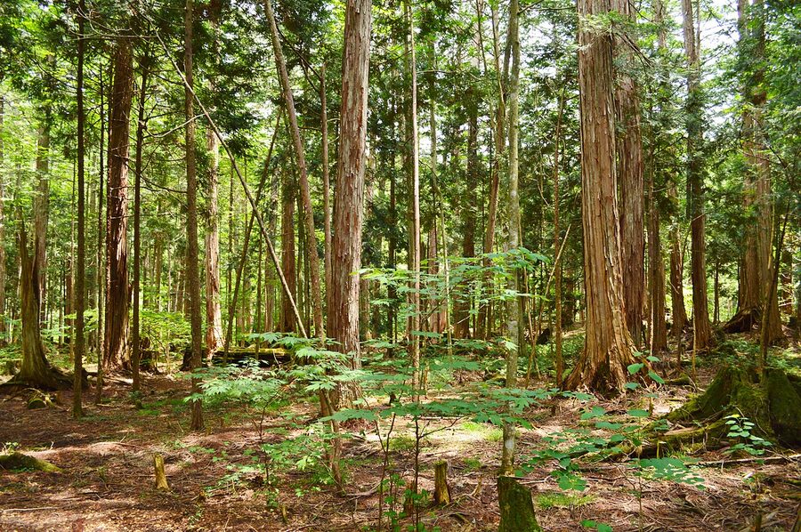
The timber thing matters because it explains why the Kiso section has such consistent visual character. The Kiso Five Trees, hinoki (Japanese cypress), sawara, asuhi, koyamaki and nezuko, were declared protected forest under direct shogunate control in the early 1700s after centuries of overcutting. Logging was restricted, the trees were managed, and the resulting hinoki became the construction material of choice for shrines, temples and high-status post-town buildings. Walk through Magome, Tsumago or Narai today and you’re looking at hinoki facades. Drop into the Akasawa Recreational Forest near Kiso-Fukushima, birthplace of the official Japanese practice of shinrin-yoku, “forest bathing”, and you’re standing in 300-year-old hinoki stands that the shogunate set aside for repair work on Ise Grand Shrine.
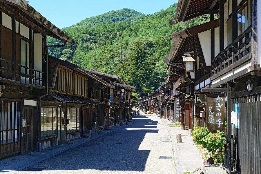
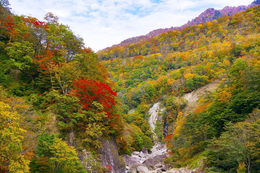
Magome to Tsumago: the famous 8km
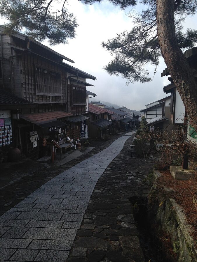
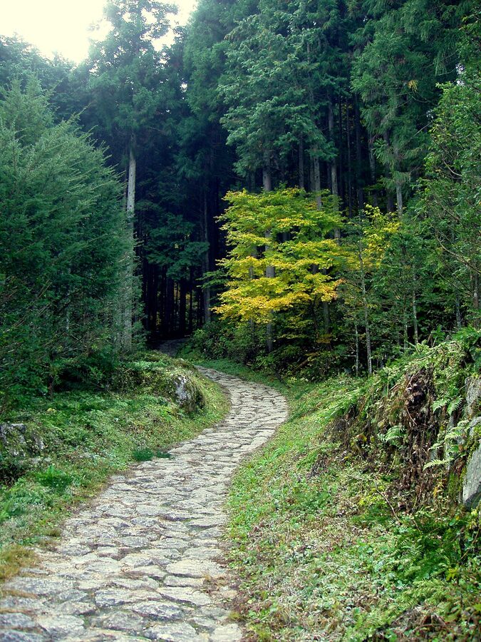
If you only have one day for the Nakasendo, walk this. The Magome-to-Tsumago stretch is 7.7km on the trail proper, takes 2.5 to 3 hours at a comfortable pace, and crosses Magome-toge, the pass at 801m that’s also the prefectural border between Gifu and Nagano. It’s mostly downhill once you’ve topped the pass. The trail is signposted in three languages, the surface is a mix of paved village road, packed earth and original ishidatami (Edo-era cobblestone), and there are tea houses, waterfalls and small shrines spaced out enough that you stop for snacks rather than for breath.
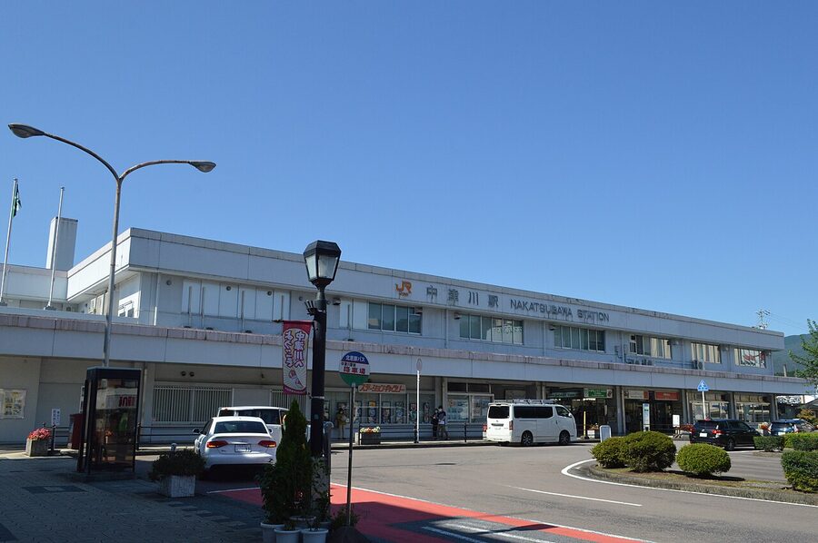
Start in Magome rather than Tsumago. Two reasons. First, you climb 200m out of Magome to the pass, then descend 350m into Tsumago, this direction is easier on the knees than the reverse. Second, Magome is on the Gifu side of the pass and connects to Nakatsugawa Station, which has a direct Limited Express Shinano service to Nagoya; Tsumago is a 10-minute bus ride from Nagiso Station, which is on the same line but slower. Trains and buses both run roughly hourly, so the practical impact is small, but you’ll appreciate the gentler descent.
The walking, beat by beat
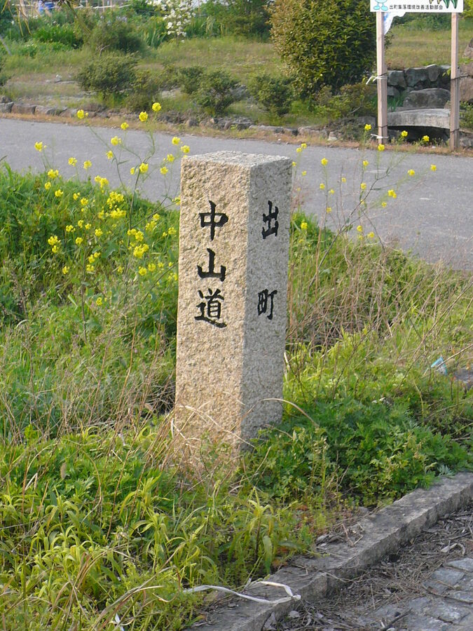
From the bus stop at the bottom of Magome, follow the climbing main street up through the post-town. The slope is steep and the cobbles are slippery in rain, proper closed shoes matter here, not sandals. About 800m in, the buildings thin out and a signposted side path peels off uphill into farmland and forest. From there it’s roughly 2.2km of climbing to Magome-toge, mostly through paved farm road and forested switchbacks. There are a couple of confusing junctions where signs point in three directions; just keep heading up and follow the kanji 中山道 (Nakasendo) on the wooden signs. Other walkers will be coming down toward you and can confirm you’re on track.
At the top there’s a small clearing with a bench, a sign confirming the prefectural boundary, and on a clear day a view back south toward Mt Ena. From the pass the trail descends steeply at first, then settles into a gentler grade through cryptomeria and mixed forest. About fifteen minutes down from the pass you’ll come to the Tateba-jaya tea house, a reconstructed Edo-era rest stop where travellers used to leave their palanquins and stretch their legs. Entry is free, the irori hearth is usually lit between November and March, and the volunteer staff serve thin green tea and pickled radish for a small voluntary donation. They speak almost no English but they understand “thank you” and a small bow, and they’ll point at things on the wall if you look interested.
From the tea house it’s another 3.1km to Tsumago. About fifteen minutes past Tateba-jaya, a wooden sign points right to Odaki-Medaki, the Male and Female Falls. They’re a 200m detour off the main trail, worth it in summer when the spray feels good and you can hear them well before you see them. After the falls turnoff the trail drops into a series of farmhouse hamlets where the path runs literally through people’s vegetable gardens. Locals are used to walkers; nod, don’t photograph people up close, and don’t stop in their driveways to take pictures of their houses.
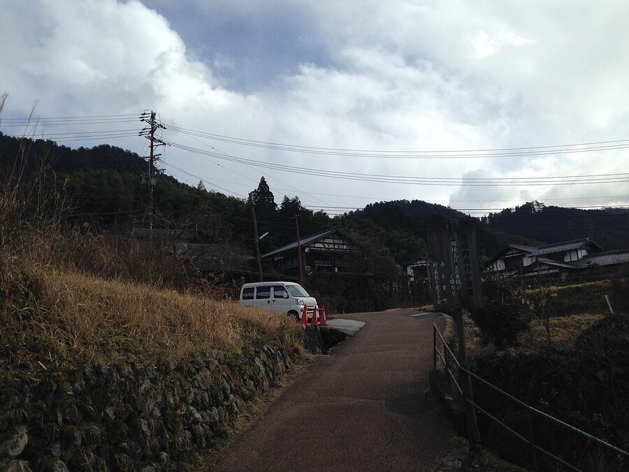
The last kilometre into Tsumago descends steeply on stone steps, then crosses a small wooden bridge over a clear stream. You arrive at the top of Tsumago’s main street, which is closed to through traffic in daylight hours. If you’re combining this walk with a stay at Narai-juku, you can pick up the train from Nagiso (10 minutes by bus) up to Yabuhara or Narai later in the day.
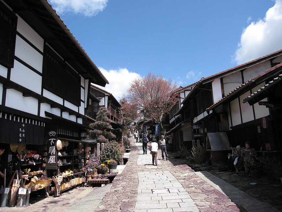
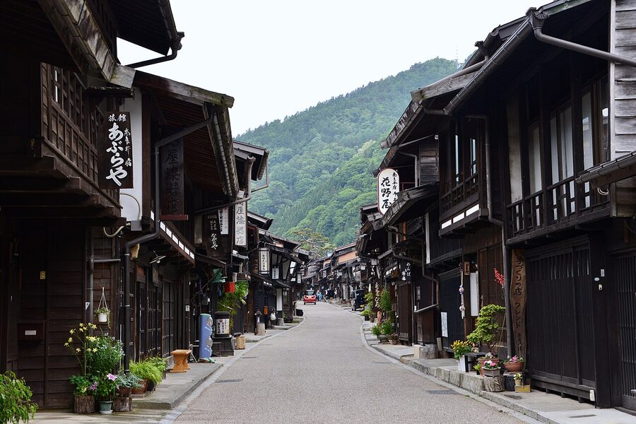
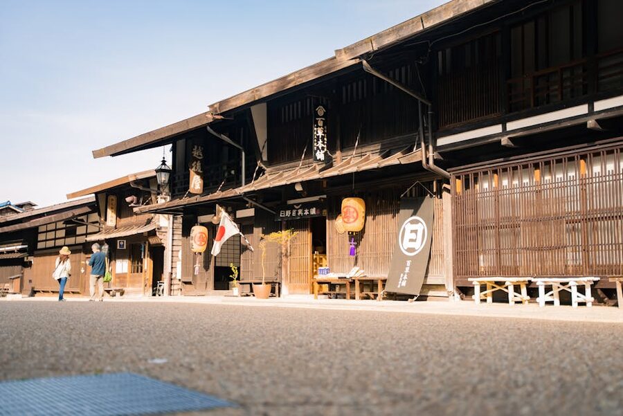
Tsumago itself
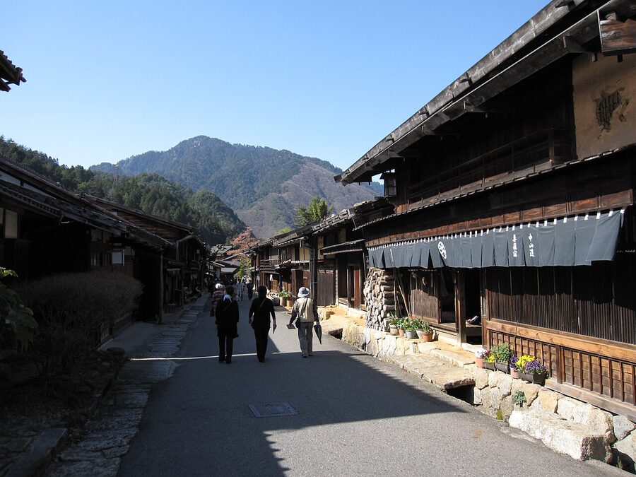
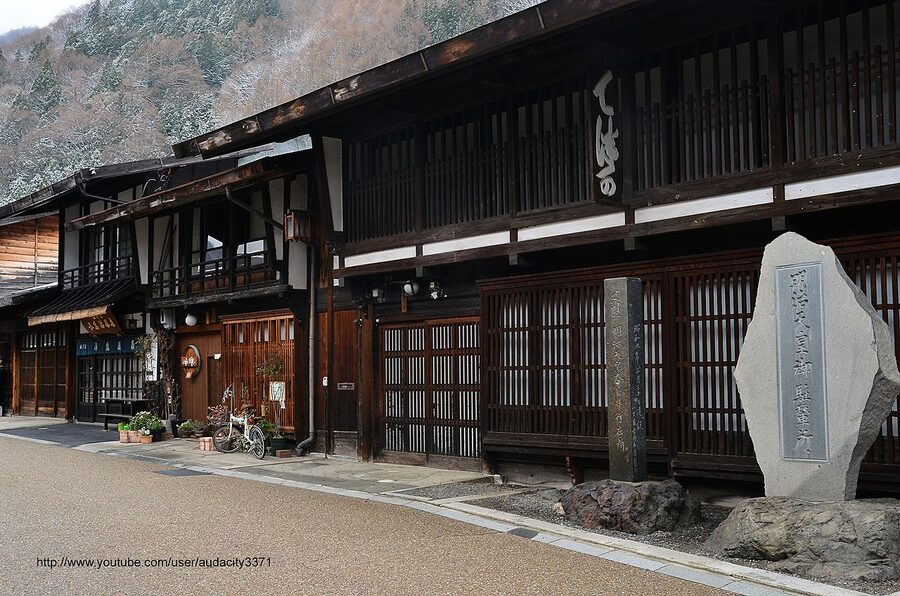
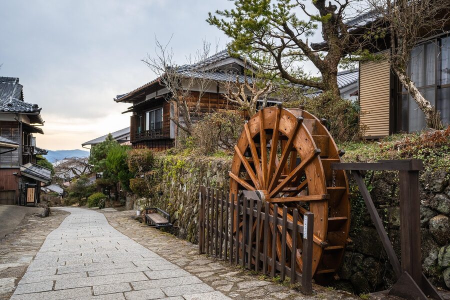
Tsumago is the post-town that started the Kiso preservation movement in the late 1960s. The local council adopted three rules, don’t sell, don’t lend out, don’t tear down, and pulled in central government funding to restore the Edo-period façades. The result is the most consistent post-town streetscape in Japan: about 800m of timber buildings with overhanging upper floors, sliding wooden shutters, low eaves, and absolutely no overhead cables. The municipality buries the wiring; what looks like an aesthetic decision is actually a planning regulation.
Walk the main street end to end (it takes ten minutes if you don’t stop, an hour if you do), look at the masugata corner, the deliberately right-angled bend in the road designed to slow attackers and force them into ambush points, and visit the Wakihonjin Okuya. It’s the restored backup high-status inn, ¥600 entry, with a guided introduction in Japanese that an English laminate sheet covers reasonably well. Skip the Honjin reconstruction unless you have a particular interest in Edo administrative architecture; it’s a 1990s rebuild rather than a survival.
Narai-juku and the Torii Pass: the harder, quieter half-day
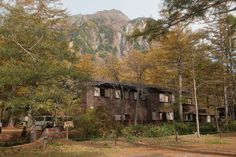
If Magome-Tsumago is the famous walk, Narai-Yabuhara is the better walk. It’s harder, 6km over a 1,197m pass with about 350m of climbing, and gets a fraction of the foot traffic. The trail is forested, the Torii Pass at the top is named for the actual torii gate that travellers used to pray at before crossing, and Narai-juku itself is more architecturally interesting than either Magome or Tsumago. The Edo-period bypass was that Narai sat at the foot of the hardest pass on the entire 540km route, so travellers tended to spend an extra night here gathering courage. The post-town grew rich enough on it to be nicknamed “Narai of a Thousand Houses.” Most of those thousand houses are still there.
Narai is administratively part of Shiojiri City, which means it shares the same JR Chuo Line that connects Shiojiri’s wider station network. To start the walk over Torii Pass, take a local train from Narai south to Yabuhara (one stop, about 12 minutes). From Yabuhara Station it’s a 1km road walk to the start of the pass trail, then 3km of climbing through hinoki forest and a final descent through what’s left of the original cobblestones.
The Torii Pass climb
The climb out of Yabuhara is the steepest sustained ascent you’ll do on the Kiso section. About 350m of elevation gain in 3km. The trail is well graded, well signposted, and surfaced with a mix of forest path and timber stairs. Expect 90 minutes up and 60 minutes down, plus 30 minutes at the top. The torii gate itself is a small one, sitting under cedars next to a shrine to Mt. Ontake, travellers who couldn’t make the pilgrimage to the volcano would pray here instead. On a clear day the gap in the canopy west of the gate gives you a glimpse of Ontake itself, white-tipped most months of the year. There’s a small shelter at the saddle where you can sit out a sudden rain shower.
Coming down into Narai you’ll pass through what’s left of the original cobblestone, a longer continuous stretch than anything on Magome-Tsumago, and exit into the back of Narai’s main street near the Hashimoto Kannon temple. From there it’s another five minutes’ walk to the post-town centre.
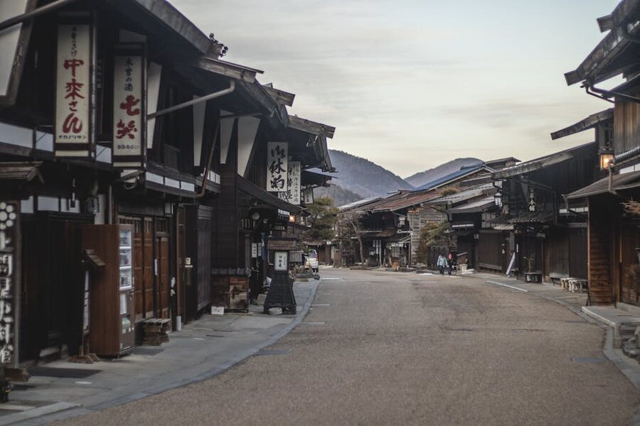
Narai itself
The post-town runs about a kilometre from the railway station at the north end down to the wooden Kiso-no-Ohashi bridge at the south. Walk it slowly. Look at the lacquerware shops, Kiso shikki is the regional style, and the workshop interiors are mostly worth more than the gift shops; the family of artisans who make them are usually on view through open doors at the back. Stop at the Nakamura Residence (¥300, closed Mondays Dec-Mar) for a thirty-minute tour of an Edo merchant’s house with original furniture in place. Skip the Kamidonya Shiryokan unless you’ve already done Nakamura and want a comparison.
The full Kiso section: 4 to 6 days end-to-end
If you have a week and you want to walk all eleven Kiso post-towns, the standard plan is Magome to Narai over five walking days. Here’s the rough division most overnight specialists use, and it’s what I’d recommend if you can take the time.
- Day 1: Magome → Tsumago (8km, 3 hours). Sleep in Tsumago. This is the easy day.
- Day 2: Tsumago → Nojiri (18km, 6 hours). The longest day. Bamboo groves, footbridges, terraced rice fields, and a less-trafficked pass at Nenoue-toge. Train from Nojiri to Kiso-Fukushima (30 min) for the night, since accommodation in Nojiri itself is thin.
- Day 3: Train to Agematsu and walk Agematsu → Suhara → Kiso-Fukushima (about 12km depending on which old-trail variant you pick). Or use this day for a side trip into the Akasawa Recreational Forest.
- Day 4: Kiso-Fukushima → Yabuhara (variable; 14km if you walk the Jizo Pass route, much shorter if you train half of it). The Jizo Pass section is overgrown in places and signage is patchy, check at the Kiso-Fukushima tourist office before committing.
- Day 5: Yabuhara → Narai over the Torii Pass (6km, 3 hours). Overnight in Narai.
This sequence ends at Narai with a direct train back to Shiojiri (25 minutes), where you can pick up the Limited Express Azusa to Tokyo or change for the Shinano line south to Nagoya and Kyoto. If you’re picking up the Nakasendo as part of a longer route, our access guide covers the rail connections in more detail.
Tokyo to Kyoto: the obsessive’s full traverse
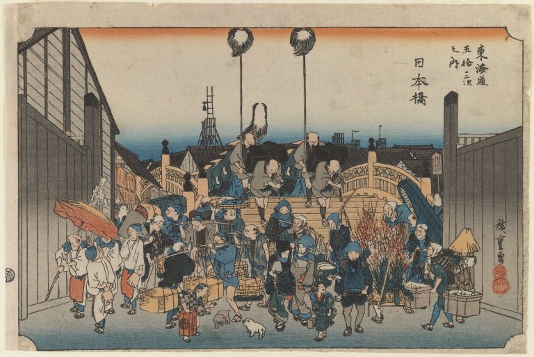
Walking the entire 540km from Nihonbashi in Tokyo to Sanjo Ohashi in Kyoto is technically possible. A few people do it every year. The realistic timeline is 18-24 walking days, and you’ll spend most of them on tarmac. The romantic post-town stretches are concentrated in three areas: the Saitama-Gunma section north of Tokyo (some surviving cobblestone around Magome, confusingly, also called Magome but a different one, near Kumagaya), the Kiso Valley (the part this guide is mostly about), and the Omi section in Shiga before you drop into Kyoto. In between, you’re walking on shoulder-of-highway, through suburbs, past convenience stores. It can be meditative if you’re in the right mood. It can also be tedious.
Most through-walkers use the JNTO long-distance walking guidebooks (in Japanese) plus Walk Japan’s own English mile-by-mile descriptions, and supplement with the kaidouarukitabi.com day-by-day walker blog. Budget 20-25 nights’ accommodation, mostly minshuku and business hotels in the off-trail towns, plus a few minor train rescues when a section is genuinely impassable. Total cost runs to about ¥350,000 to ¥500,000 for the trip including food, sleeps, and incidental transport, depending on how often you sleep in business hotels versus traditional inns.
Getting to the trail
From Tokyo
For the Magome-Tsumago daytrip or overnight, the route is Shinjuku → Shiojiri → Nagiso (Limited Express Azusa to Shiojiri, then Limited Express Shinano south, total 3.5 to 4 hours, around ¥9,500 each way) or Tokyo → Nagoya → Nakatsugawa (Shinkansen Hikari then Shinano, total 2.5 hours, around ¥13,000 each way and faster but more expensive without a JR Pass). For Narai, the Azusa route to Shiojiri then a local train south is the only sensible option, total about 3 hours from Shinjuku. The JR Pass covers the Azusa, the Shinano (non-Nozomi shinkansen), and the local trains, so passholders should default to Shinjuku-Shiojiri.
From Kyoto
From Kyoto Station the standard route is Shinkansen Hikari to Nagoya (35 minutes), then Limited Express Shinano north to Nakatsugawa (48 minutes for Magome) or all the way to Kiso-Fukushima (90 minutes) or Shiojiri/Narai (2 hours). Buy a single ticket through to your final destination, the connection in Nagoya is signed in English and easy to make in fifteen minutes. If you’re combining the Nakasendo with Matsumoto, the Shinano trains from Nagoya stop at Matsumoto a few stations after Shiojiri, so the geometry works for either direction.
The local buses
Two bus lines matter. From Nakatsugawa Station the Magome-bound bus runs roughly hourly between 07:00 and 18:00, takes 25 minutes and costs ¥570. From Nagiso Station the Tsumago-bound bus is shorter (10 minutes, ¥300) and slightly less frequent. For both, pay the driver in cash on exit; small change is appreciated. There’s a stop called Tsumagobashi about 200m from the bottom of Tsumago’s main street where most walkers catch the bus down to Nagiso for the train back out.
Luggage forwarding: how to walk light
This is the single thing that makes or breaks the experience. The post-town accommodation is overwhelmingly traditional, and traditional means low ceilings, narrow corridors, futon-and-tatami rooms, and absolutely no room for a 70-litre wheelie suitcase. You will be miserable trying to manhandle one up Magome-toge.
Two options. First, the Tsumago Tourist Information Office runs a same-day baggage forward service between Magome and Tsumago (and the reverse direction): they pick up by 11:30, deliver by 15:00, ¥1,000 per bag, no booking needed if you arrive before 11:00. The same service runs late March to late November; in winter the price doubles and the turnaround stretches to next-day. Second, for longer trips, use Yamato Transport’s takkyubin (often branded “Kuroneko”) to forward your main luggage from your previous hotel directly to wherever you’re sleeping next. Cost runs ¥2,000-¥3,000 per bag for inter-prefecture transit, takes one to two days, and is reliable to the point of legend. Tell your hotel reception “takkyubin” and the destination address; they’ll handle the paperwork.
Either way: keep a daypack with rain gear, water, snacks, your phone, your wallet and a change of socks. Anything heavier than that and you’ll resent every kilometre of the trail.
Where to sleep along the way
The Kiso post-towns are mostly served by minshuku, family-run inns with shared bathrooms, futons on tatami, and a fixed two-meal-a-day arrangement. Expect ¥10,000-¥18,000 per person per night with both meals, paid in cash at checkout. Cards are accepted at the larger ryokan but not at the small minshuku. Reservations need to be made directly, often by phone in Japanese; many tourist offices in the bigger gateway stations (Matsumoto, Nakatsugawa) will phone-book on your behalf for free if you ask.
In Magome
Tajimaya is the standard recommendation, a 17th-century townhouse on Magome’s main street, run by the same family for generations, ¥15,000ish per person with two meals. Magome Chaya is the backup if Tajimaya is full and gets you a comparable experience for slightly less. Both book up six months ahead in cherry blossom and autumn-colour weeks; off-season it’s usually fine to book a week in advance.
In Tsumago
Tsumago has the densest cluster of small minshuku of any post-town. Matsushiroya, Daikichi and Hanaya are the three I’ve heard most consistently good things about; all are family-run, all are in restored Edo buildings, all serve a kaiseki-style dinner with sansai (mountain vegetables), river fish and gohei mochi. For something with a private bathroom, look at Iseya. For genuinely upscale, modernised but still architecturally sensitive, Zenagi is in nearby Nagiso rather than Tsumago proper, but it’s only fifteen minutes by car and they’ll send a driver from the station.
In Kiso-Fukushima
Kiso-Fukushima is the largest of the Kiso towns and has the broadest accommodation range. Onyado Tsutaya is the famous old ryokan, Edo-period roots, hot-spring bath, on-site restaurant doing the regional sansai cuisine well. Tsutaya recently launched a “shogun’s dinner” full kaiseki recreation of an Edo-period daimyo’s banquet, ¥20,000 supplement; it’s gimmicky but the food is excellent. Kisoji-no-Yado Iwaya is the rustic alternative, smaller, with mountain-facing rooms and a private outdoor bath.
In Narai
BYAKU Narai is the modern luxury option, a converted Edo-era sake brewery turned design hotel, ¥40,000+ per person with meals. Worth it if you want one extravagant night on the trail; otherwise overkill. For minshuku, Iseya has been running since the Edo period and still feels like it. Shimadaya does smaller groups and has the best ofuro (a single deep cypress tub fed by the local cold spring; not a true onsen but the architecture is satisfying).
What to eat in the post-towns
The Kiso eats well above its size. Three things you should make a point of trying:
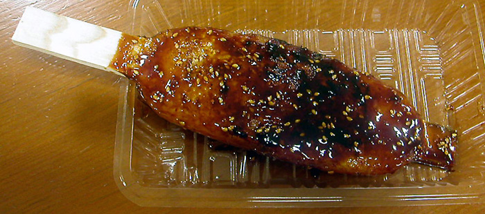
Gohei mochi. Pounded rice flattened onto bamboo skewers, brushed with a miso-walnut paste (the version locals call “kurumi”) or a miso-sesame paste, and grilled over charcoal. Every post-town has a couple of stalls or tea-room kitchens turning these out fresh. The texture is firmer than mochi proper because the rice is pressed but not pounded to dough. Best examples in my experience: Kotokuya in Tsumago, or any of the open-fire tea houses on the Magome main street.
Sansai soba. Cold soba topped with mountain vegetables, bracken, butterbur, wild mushrooms, and a separate dipping broth. The soba in this region is buckwheat-heavy (the Kiso doesn’t grow much wheat), so it’s nuttier and rougher than Tokyo-style soba. Kurumaya in Magome and Suehiro in Tsumago are reliable. Avoid the touristy soba in Narai’s main strip in favour of one of the side-street places, locals queue at lunchtime, which is the best signal.
Sunki-zuke. Fermented turnip greens, the only major Japanese pickle that uses no salt, fermented instead with lactobacilli that survive only in the Kiso climate. It’s an acquired taste; sour in a sharp, almost grape-skin way. You’ll get it as a side dish at almost any ryokan dinner. If you like it, the small grocery shops in Kiso-Fukushima sell vacuum packs to take home; it survives a flight if it’s properly sealed.
What to wear and what to bring
The trail isn’t technical, but it’s also not a flat city walk. Three things matter.
Footwear. Light hiking boots or trail shoes with proper grip. Sandals are wrong for this, the cobblestone is genuinely slippery in any rain, and the descents from the passes have enough loose gravel to twist an ankle if you’re in flat-soled shoes. I’ve watched a couple turn back at the Magome-toge in heavy rain because their fashion trainers couldn’t grip. Don’t be them.
Layers. The valley microclimates are dramatic. Magome at 600m can be pleasantly warm at the same hour Narai at 940m is in cold mist. Bring a thin merino base, a long-sleeved layer, and a waterproof shell. In summer add sun protection and a hat, there are exposed sections above Magome that bake in afternoon sun. In winter (December to March) bring proper boots, gaiters and microspikes; the Magome-toge rarely gets impassable but the descent into Tsumago can ice over.
The small things. A daypack with two-litre water capacity, energy snacks (the post-towns have very few convenience stores; Lawson has one in Nakatsugawa and one in Kiso-Fukushima, and that’s it), a printed map (mobile signal is patchy in the forested sections), basic first aid for blisters, and cash. Many of the small businesses on the trail still don’t take cards or IC cards. Withdraw ¥30,000 in Nakatsugawa or Shiojiri before you start. The 7-Eleven ATMs accept foreign cards reliably; the Japan Post ATMs in the post-towns themselves are hit-or-miss.
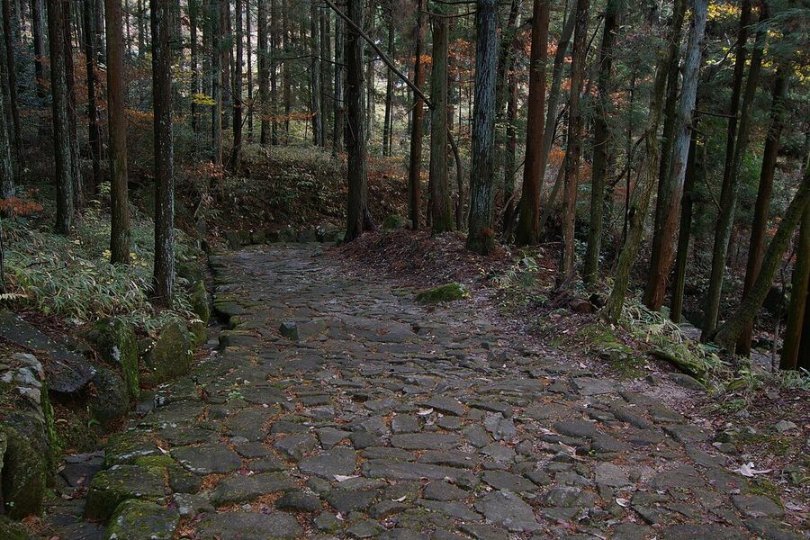
The cobblestone close-up
When to walk
Spring (mid-April to early May) and autumn (late October to mid-November) are the obvious choices, and both are crowded. The cherry blossom in Magome lands a week or two later than in Tokyo because of the elevation; in Narai it can be ten days later still. Autumn colour peaks in Narai around 25 October and in Magome around 5 November. If you want a quiet walk, aim for the weekday between two weekends in either window, the day-tripper buses are mostly weekend traffic.
Summer (June through August) is hot and humid in the lower valleys and lovely in the higher ones; June carries a 20% rain probability on most days because of the rainy season, July and August carry 10-15% but with thunderstorm risk in afternoons. The forested sections of trail are pleasantly cool in 30°C heat, but the open road sections in and out of the post-towns are hard work.
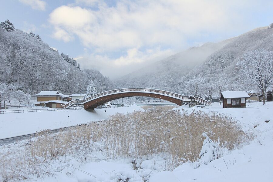
Winter (December through early March) is the surprise. The post-towns under snow are something else entirely, the day-tripper traffic vanishes, the minshuku that stay open are warm and overfeed you, and the trail is walkable in microspikes on most days. Some lodgings close between January and mid-March; check before booking. The buses occasionally don’t run when it dumps overnight, in which case the Nagiso-Tsumago and Nakatsugawa-Magome connections become taxi-only (¥3,000-¥5,000 each way).
Permits, signs, and the practicalities of the walk
You don’t need a permit. You don’t need to register anywhere. You don’t need a guide. The trail is signposted in Japanese, English and (on the Kiso section) Korean, and the signage is good enough that I’ve never met a walker who genuinely got lost on it. The bear bells on the posts above Magome-toge are not a joke, black bears do live in the Kiso forests, and there are confirmed sightings each year, mostly in early summer when bears come down from the higher slopes looking for berries. Ring the bells. Walk in groups where you can. Don’t carry food in unsealed bags.
The trail closes to walkers in extreme weather, but “closes” in this context just means the volunteer marshals at either end suggest you don’t go and won’t help if you’re injured. There’s no physical gate. Use common sense: don’t walk in lightning, don’t walk in heavy snow without microspikes, don’t try to do Magome-Tsumago in deep summer at 14:00 in 35°C heat (start at 07:00 instead). Mobile signal is reliable in the post-towns and patchy on the trail; don’t rely on a phone for navigation.
What to combine it with
A Nakasendo daytrip slots cleanly between Tokyo or Kyoto and the rest of central Honshu. Matsumoto is two hours north of Narai and makes the obvious overnight on the way to or from the trail; Matsumoto Castle is one of Japan’s five surviving original keeps. Shiojiri sits between Narai and Matsumoto and has its own quiet appeal, the Hirasawa lacquerware district is fifteen minutes from Narai by train and worth a half-day if you’ve fallen for Kiso shikki.
South of the trail, Nagoya is 90 minutes from Nakatsugawa and works as a transit base for connecting to Kanazawa, Kyoto or Osaka. North-east, Karuizawa is two hours away on the Hokuriku Shinkansen and is the genteel mountain summer-resort end of Nagano if you want a different kind of mountain stay after a Nakasendo walk. West, the other Edo-era preservation site worth combining is Shirakawa-go, the gassho-zukuri farmhouse village a couple of hours from Takayama, the same instinct to preserve everyday architecture of a vanished period, an entirely different building tradition.
Or stay another night in Kiso-Fukushima and just walk the Akasawa hinoki forest the next morning. The slow turn from “I’m in Japan” to “I’m in the actual countryside someone wrote about three centuries ago” takes about that long.