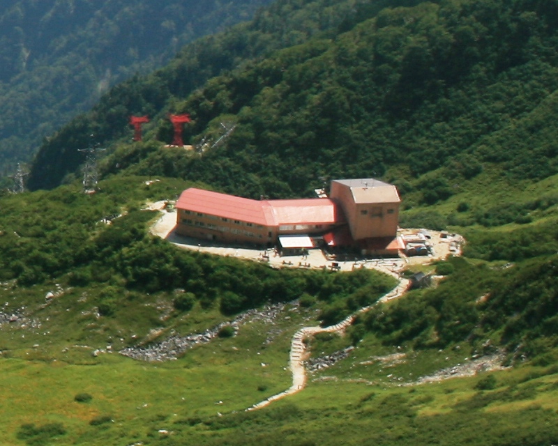
Japan has more than a hundred ropeways, and the one that climbs out of Komagane lifts you 950 vertical metres in seven and a half minutes. That makes the Komagatake Ropeway both the highest aerial line in the country, with a top station at 2,612 metres, and one of the fastest alpine ascents anywhere on earth. You step off the cabin and you are in a glacial cirque called Senjojiki, named for being roughly the size of a thousand tatami mats laid edge to edge, with a wall of 2,800-metre peaks closing in on three sides. There is no walk-up. There is no warm-up valley. The alpine zone arrives in your lap.

This is the Central Alps, the Kiso Range, the only one of the three Japan Alps that is consistently ignored by foreign visitors. The Northern Alps gets Kamikochi and the Hotaka traverse. The Southern Alps gets the long ridge walks. The Central Alps gets a single ropeway, a single hotel, and a sprawling Japanese-language search volume that translates to a vanishing English signal. That is the gap this guide is here to fill.
In This Article
- What you actually arrive at
- The ropeway, and why it matters
- Fares, timed tickets, and why you book ahead
- The cabin ride itself
- The 45-minute cirque-floor loop, for everyone who is not hiking
- Mt Hokendake, the peak you can see from the loop
- Mt Kiso-Komagatake, the actual peak
- Honest difficulty rating
- The ptarmigan, and why this is a wildlife story
- Alpine flora season, mid-July to early August
- Autumn colour, two weeks earlier than the Northern Alps
- Spring snow corridor and ski option
- Hotel Senjojiki, Japan’s highest hotel
- The lounge and terrace
- Getting there from Tokyo, Nagoya, and Osaka
- Highway bus from Shinjuku, the recommended route
- Train via the Chuo Main Line
- From Nagoya and Osaka
- Driving and parking
- Eat and drink in Komagane town
- The wider Central Alps view, from the cirque
- Combining Senjojiki with the rest of your trip
- Practical: when to skip Senjojiki
- What to bring
- Winter at Senjojiki
- Sister destinations on this site
- One last thing
What you actually arrive at
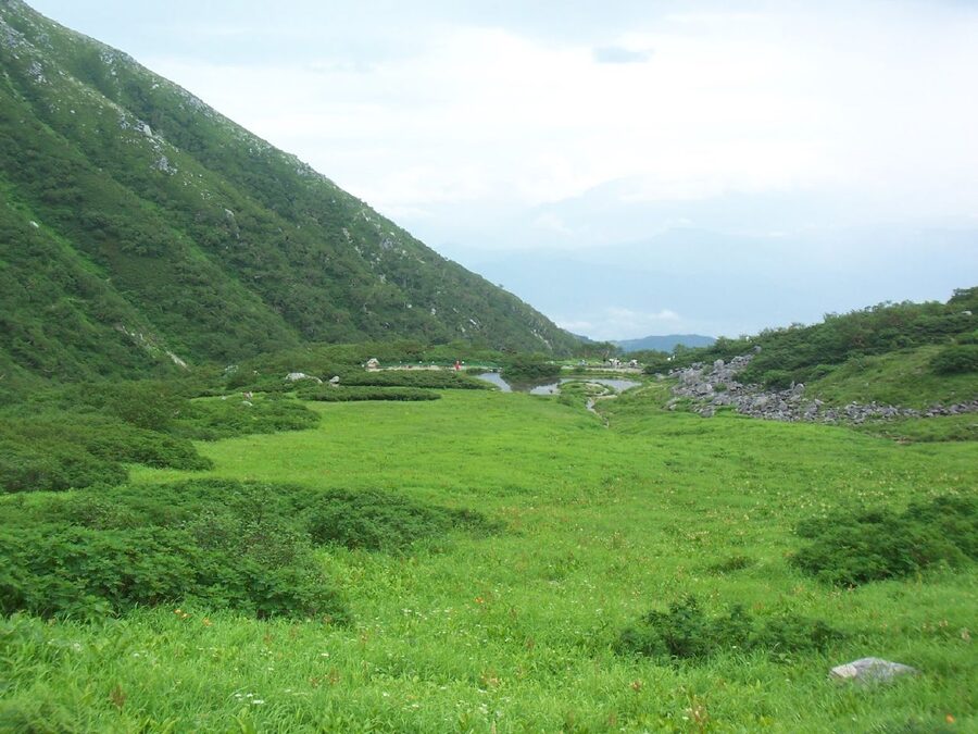
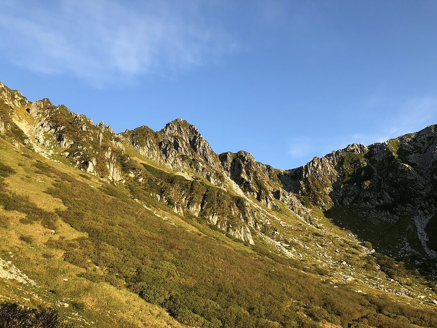
The cirque sits directly under Mt Hoken (2,931m), which is the jagged grey spire you will see from every photograph. Behind Hoken, hidden from the cirque floor, is Mt Kiso-Komagatake at 2,956 metres. That is the main peak, the highest in the Central Alps, and one of Japan’s 100 Famous Mountains. Nothing in the Kiso Range crosses the 3,000-metre line, but Senjojiki reaches close enough that the air feels thin the moment you walk out of the cable-car shed.
A cirque, in case you have not run into the word before, is a bowl carved into a mountainside by a glacier. Senjojiki was scooped out around 20,000 years ago, during the last ice age, by a slowly receding glacier that ground the granite into a near-perfect amphitheatre. The walls rise nearly 300 metres above the floor. The drainage runs out one side and tumbles down a series of waterfall steps. The acoustics are strange: voices from a hundred metres away come back as if they were next to you.
The “thousand tatami mats” name is a Japanese tatami-room joke that has, somehow, stuck. The actual cirque floor is somewhere closer to 2,000 mats, but the kanji is poetic and the figure was rounded down. You will see this referenced everywhere on the official Chuo Alps Kanko site and on every Japanese-language guide.
The ropeway, and why it matters
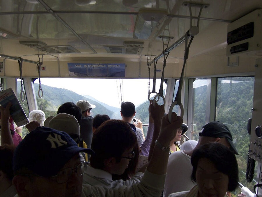
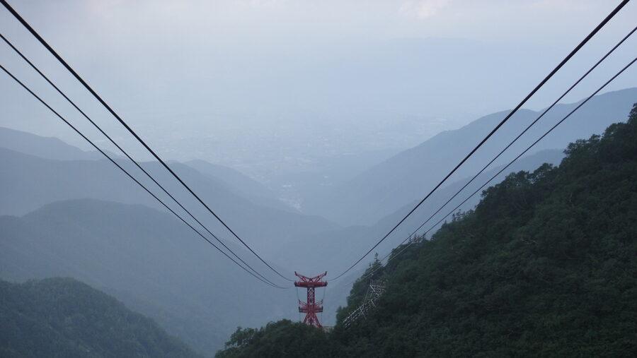
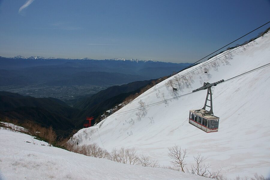
The Komagatake Ropeway opened in 1967 and was the first mountain ropeway built in Japan. It is also still the highest. The bottom station is Shirabidaira at 1,662m, and the top station is Senjojiki at 2,612m. The vertical climb is 950 metres. The cabin covers it in about 7 minutes 30 seconds. There is no other way to gain that altitude in that time anywhere in the country, and there are very few places worldwide that match it.
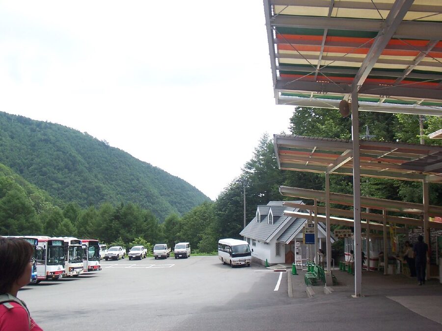
Private cars cannot drive to Shirabidaira. The road from the bottom of the valley is closed to private vehicles year-round, and you have to switch to a route bus at the Suganodai Bus Centre. The bus is a 30-minute climb up the gorge to the ropeway base. Then the cable car. Then the cirque.
Fares, timed tickets, and why you book ahead
Ropeway return fares vary by season, with three rough tiers in 2025: low season at around ¥4,210, shoulder at ¥4,640, and peak (autumn colour weeks) at ¥5,150 round trip. Add the route bus from Suganodai at about ¥830 each way. The full bus-plus-ropeway round-trip from Suganodai sits between ¥5,800 and ¥6,800 depending on the date. Bring a 10% discount on the ropeway portion if you have a foreign passport on you.
From late September through mid-October, the operator runs a timed-ticket reservation system. You book a specific ascent slot in advance because the cabins fill long before the queues clear. Without a slot you can wait two to three hours on a peak Saturday, and that is not an exaggeration: it is what every Japanese-language hiking blog warns about, and the YAMAP entries from October weekends back it up. If you are going during the autumn-colour week, buy the digital combined ticket through KKday or the official site at least a week ahead.
The cabin ride itself
The cabin holds 61 people. It is one of the larger cars in any Japanese ropeway, and the windows are big enough that everyone can see out. On a clear day you cross over the Hinokure Falls (the so-called 38-step waterfall), then climb past a section called Nakagosho where the gorge narrows, then approach Senjojiki Station with the sheer face of Mt Hoken filling the upper window. Mt Fuji is visible, faintly, on the southern horizon if the air is dry. That is one of the unexpected pleasures of the line: you can see Fuji from a Central Alps cable car.
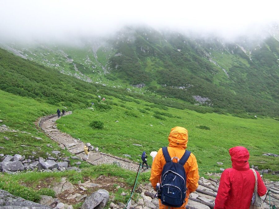
The 45-minute cirque-floor loop, for everyone who is not hiking
You do not have to hike. You do not even have to walk far. There is a paved loop that runs around the lower edge of the cirque, takes 40 to 60 minutes at an easy pace, and gives you full views of Mt Hoken, the cirque walls, and the seasonal flora at your feet. This is the route most visitors take. Families with young children take it. People in casual day clothes take it. Older travellers who would never attempt a peak hike take it.
The high point of the loop is a small pond called Kengaike, set into the cirque floor about 20 minutes from the station. On a still morning it mirrors Mt Hoken cleanly enough to be the standard postcard shot. On a windy afternoon the surface rumples and the photo gets harder, which is partly why the early-morning crowd is bigger than the afternoon one.
A few honest notes. The path is exposed: there is no shade, and the alpine sun at 2,612 metres is much harsher than the temperature suggests. Bring a hat. Bring water. Even in August the average temperature on the loop is about 11 to 12 degrees, but the UV at altitude is brutal. People underestimate it constantly. And in winter, from roughly mid-November through April, the loop closes entirely. You can still ride the ropeway up, but the cirque floor itself is buried.
Mt Hokendake, the peak you can see from the loop
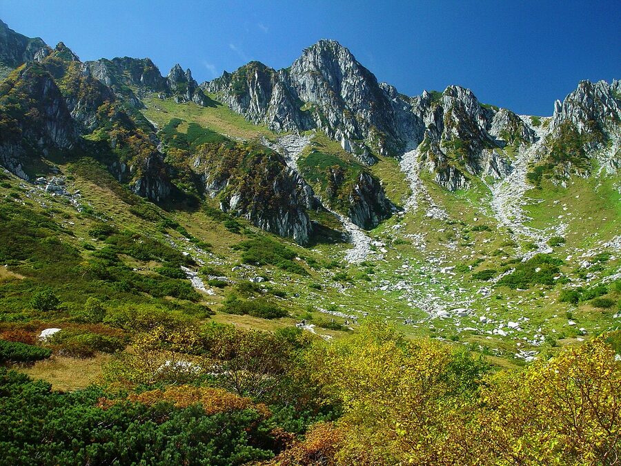
Hokendake is the dramatic-looking peak you see from the cirque. At 2,931m it is shorter than Kiso-Komagatake, but it looks bigger because it stands closer and rises more steeply. Climbing it is a different proposition from the loop walk: there are chains, fixed ropes, and a knife-edge ridge where slipping has consequences. Japanese-language accident logs treat Hokendake separately from the rest of the range for that reason.
If you are not an experienced climber, do what most people do and skip the actual summit. The path bypasses Hokendake by traversing the col below it, called Norikoshi Jodo, which translates roughly to “the pass to the pure land”. From there it is an easy ridge walk over Mt Naka (2,925m) and on to Kiso-Komagatake. Read our altitude sickness guide before you go: the air at 2,900 metres is thin enough that even fit hikers feel it within an hour, and the route up to Norikoshi from the cirque is steep.
Mt Kiso-Komagatake, the actual peak

From Senjojiki Station the round trip to the summit of Mt Kiso-Komagatake is roughly 3.5 km, with about 490 metres of elevation gain, and most fit hikers do it in 4 hours including breaks. That is short by Japanese alpine standards: the comparable Hotaka traverse from Kamikochi runs to two days. It is also why this hike is recommended for first-time alpine hikers in Japan, especially the Japanese-language hiking sites where it shows up on every “first 3,000-metre-class peak” list (it is not quite 3,000m, but the range is treated as such).
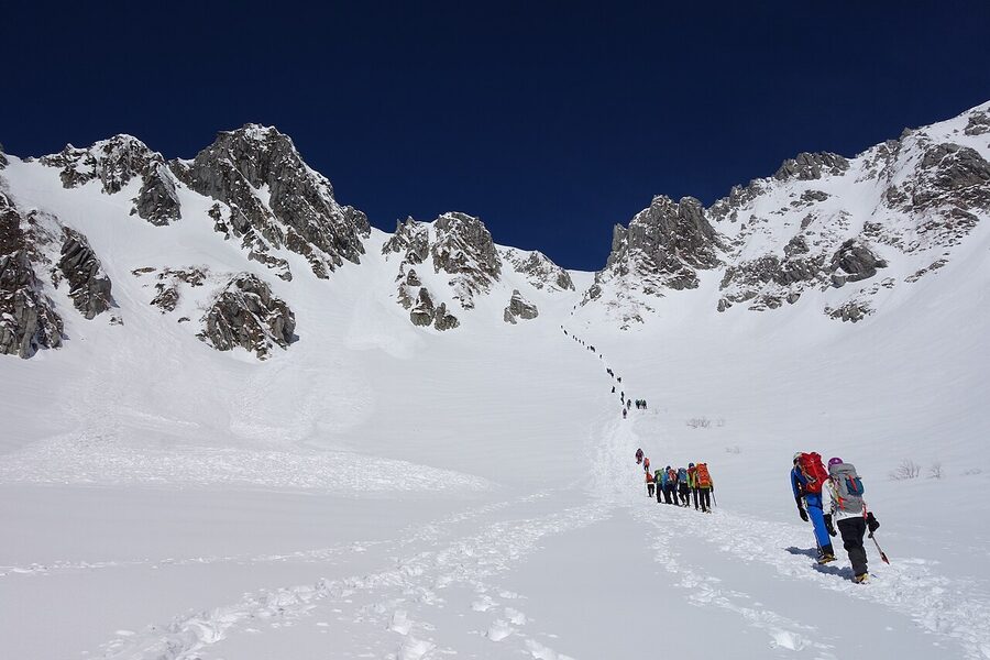
The opening section is a steep climb called Hatchozaka, which means “eight-stretch hill”. You leave the cirque floor behind in about 45 minutes and pop out on Norikoshi Jodo at the top of the wall. From here, suddenly, you are on a high ridge looking down on Senjojiki and across at the entire Northern Alps. It is one of the more dramatic transitions in Japanese alpinism: cirque-bowl one minute, open ridge the next.
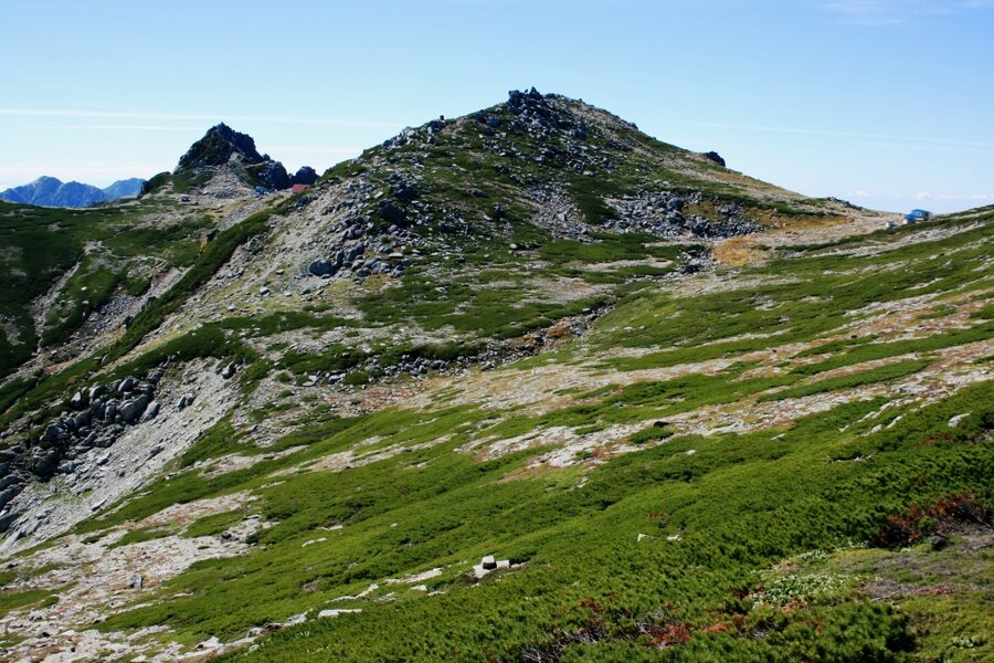
From Norikoshi Jodo you walk past Hokendake-sanso, the mountain hut at the col, and on toward Mt Naka. The ridge to Mt Naka takes about 10 minutes. From Mt Naka you can see Kiso-Komagatake itself for the first time: a wide rounded shoulder, less dramatic than Hoken but commanding a far bigger horizon. There is a brief descent and re-ascent, with another mountain hut and tent platform at the saddle, before the final 30-minute climb to the summit.
The summit is broad. There is a small Shinto shrine on the ridge (Shinshu Komagatake-jinja), a triangulation marker, and a wooden post with the elevation. On a clear day you can see Mt Fuji to the south-east, the Yatsugatake range to the east, and the entire Northern Alps spread out to the north. On most days some of those are blocked by cloud, but the view across the Central Alps and back down to the cirque is still excellent.
Honest difficulty rating
Japanese hiking sites grade Kiso-Komagatake from the ropeway as a beginner-to-intermediate route. That is fair, with caveats. The trail itself is well-maintained and well-marked. The elevation gain is modest. But you start at 2,612m, and altitude is real. People who skip the cirque-floor loop and head straight up Hatchozaka often report headaches and dizziness on the first ridge. Spend at least 30 minutes at the cirque floor before starting the climb. It is the cheapest insurance you can buy.
The other caveat is the descent. Coming back down Hatchozaka in the afternoon, when you are tired, with rocks that have been wet by passing showers, is the worst part of the hike. Trekking poles help. So does going down slowly. Most of the rescues recorded on the JA Yamap accident logs happen on this section, not on the summit.
The ptarmigan, and why this is a wildlife story
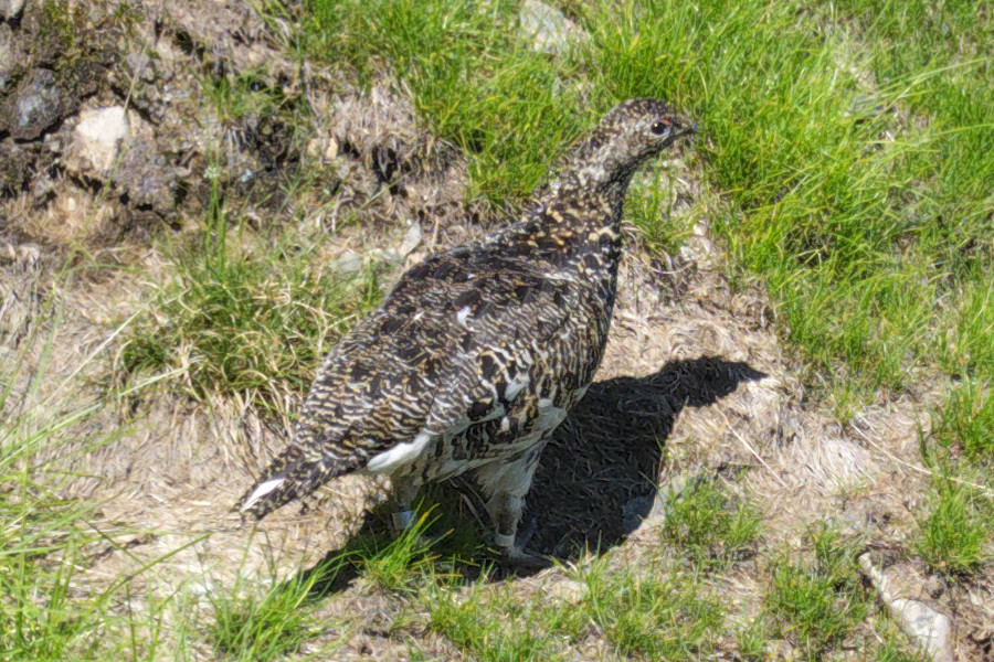
Raichou, the Japanese rock ptarmigan, is the bird every Japanese hiker hopes to see. It is a sub-species that arrived in Japan during the last ice age, when there was a land bridge to the Asian mainland. Raichou cannot survive at low altitude, so they are stranded in the high alpine zones of the Northern, Central, and Southern Alps. The Northern Alps still has thousands. The Central Alps had none, for a long stretch of decades.
The Central Alps population went extinct in the 1960s. From 2018 the Ministry of the Environment began a re-introduction programme, taking eggs from the Northern Alps and raising chicks in protected enclosures around Norikoshi Jodo and the Mt Naka ridge. By 2024 some chicks were being raised in the wild on Kiso-Komagatake, and you can see ministry staff in orange vests on the ridge during summer monitoring the families. They are happy to point out where to look but are firm about distance: stay back, do not feed them, do not crouch in the path.
The chances of seeing one are not high but they are not zero either. Most hikers I have spoken to who summited in July or August saw at least one. October sightings are rarer because the families have started to move down. Winter raichou turn pure white and blend into the snow, which is part of the reason almost no-one reports seeing them in the cold months.
Alpine flora season, mid-July to early August
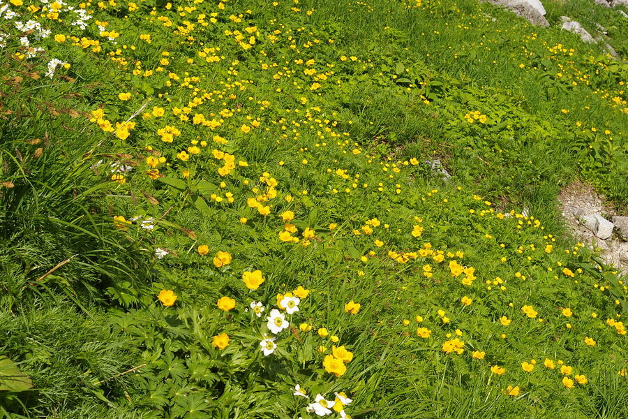
Alpine flora at Senjojiki peaks between mid-July and mid-August. The cirque hosts roughly 150 species, including kobaikeso (white globe-flower), koiwakagami (a delicate pink alpine), chinguruma (a low cushion shrub with white flowers and red autumn seedheads), tsugazakura, and miyama-kuroyuri (the dark “fritillary” lily that locals call “black yuri”). The official Chuo Alps Kanko site keeps a current bloom list, with mid-July as the start and the third week of August as the realistic close.
If you are going specifically for the flora, target the last weekend of July or the first weekend of August. The bloom shifts quickly: a flower at the cirque floor in mid-July can be gone by the time you climb to Norikoshi. The higher slopes flower a week or two later, so a late-July visit catches the cirque in full bloom and the ridge at the start of its peak. By mid-August the cirque flora is fading and the hokendake-sanso ridge is at its best.
Autumn colour, two weeks earlier than the Northern Alps
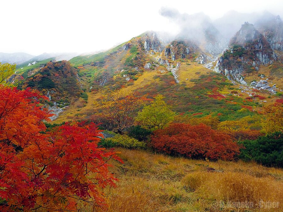
Here is a thing that catches first-time visitors out: Senjojiki autumn colour peaks earlier than Kamikochi or the Tateyama-Kurobe Alpine Route. The reason is geographical. The Central Alps face south and east. The cirque catches the shorter autumn days harder than the Northern Alps does, and the cold sets in faster. Peak colour usually falls between the third week of September and the first week of October, with the hill-station colour tapering down through mid-October and the cirque turning to first snow by late October.
If you are coming from the Northern Alps schedule (Kamikochi typically peaks around 10 to 20 October), you will think you have missed it. You probably have, by a week or two. Plan for a Senjojiki autumn visit two weeks earlier than your Kamikochi or Tateyama plans.
Autumn is the busiest season at Senjojiki by a wide margin. Saturday queues for the ropeway can stretch beyond two hours despite the timed-ticket system. Hotel Senjojiki sells out months ahead. The Japanese-language hiking sites recommend two strategies: weekday-only visits, ideally Tuesday or Wednesday, or the very first ascent of the day, which means catching the 5 a.m. bus. Either works. The Saturday-morning compromise does not.
Spring snow corridor and ski option
From mid-April to late May, Senjojiki is one of the few places in Japan where the cirque floor doubles as a backcountry ski slope. The Senjojiki Ski Area is a temporary spring-only operation: no lifts other than the ropeway, no groomed runs, just open powder bowl with the option to walk up Hatchozaka and ski down. Backcountry tools are required (avalanche transceiver, probe, shovel) and most regulars come up with a guide. The official site has the operating dates posted each year.
The April-May window is also when the cirque has its closest equivalent to the Tateyama snow corridor: the ropeway carves a shallow snow tunnel through metres of accumulated snow at the upper station, and you walk out into a cirque that is still half buried. It is a different visit from the summer one. Bring sunglasses regardless of the weather, because the reflected glare is intense. Read our skiing guide for a wider view of spring options across the Japan Alps.
Hotel Senjojiki, Japan’s highest hotel
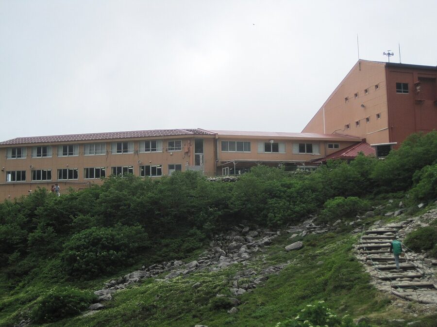
Hotel Senjojiki is the only accommodation in the cirque, attached to the upper ropeway station, and at 2,612m it is the highest-elevation hotel in Japan. Sixteen rooms total. About half face the cirque, half face the Southern Alps to the east. The rooms are simple Japanese-style 10-tatami layouts, some with private bath. Dinner and breakfast are included, and the dining room has windows on the cirque side. Check our mountain hut booking guide if you have not stayed at this kind of altitude before, since the booking norms are different.
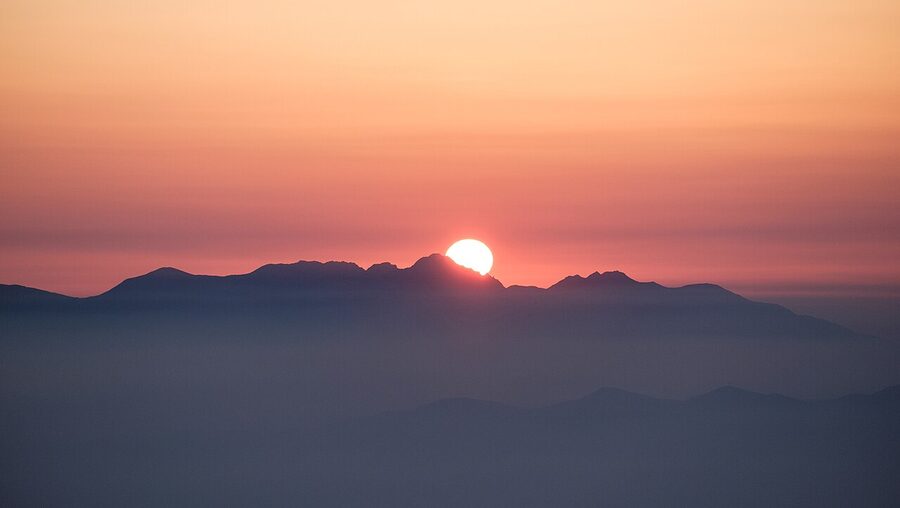
The reason to stay is sunrise. Morgenrot, the alpine word for dawn alpenglow, is what people come for. The sun rises over the Southern Alps and turns Mt Hoken’s east face deep red for about five minutes. From a regular ropeway day-trip you can never see this, because the first cabin up is too late. From the hotel you walk out onto the wooden terrace at 4:30 a.m. and you are alone with the light.
The hotel is small and gets booked out months ahead for autumn weekends and the late-July flora peak. It is also expensive: from around ¥28,000 per person on a half-board basis in 2025, with peak rates climbing past ¥35,000. If you want a half-day acclimatisation walk before a Kiso-Komagatake summit attempt, it is worth the cost. Otherwise the hotels in Komagane town are a fifth of the price and a 90-minute round trip away by bus.
The lounge and terrace
If you are not staying overnight, you can still use the hotel’s facilities. The “2612 Cafe” inside the building serves a passable curry rice and a coffee for around ¥1,200, with windows on the cirque. The wooden outdoor terrace called “SO-RA-TO-KI” is open to day visitors and is the best photo platform on the property. The east-facing Lounge 2612 is a paid-by-the-hour private space during the day and free to overnight guests in the evening, when the stars come out.
Getting there from Tokyo, Nagoya, and Osaka
There are four practical ways in. Three of them work for foreign visitors without a car.
Highway bus from Shinjuku, the recommended route
The most efficient option is the highway bus from Shinjuku Busta to the Komagane Interchange stop (“Nyotai-iriguchi”), about 4h30 each way for around ¥6,900 single. From there a route bus runs to Suganodai Bus Centre and on to Shirabidaira at the ropeway base. Total Shinjuku-to-cirque time is around 6 hours and 8 hours including the ropeway and a brief acclimatisation walk. There are 17 buses each direction every day. The buses have USB ports, free wifi, footrests and a toilet on board. Buy through Highwaybus.com.
If you are doing this as a day trip, the operator sells a combined ticket called the “Komagatake Senjojiki Cirque Ticket” for around ¥12,500 round trip from Shinjuku, which bundles the highway bus, route bus, ropeway, and a hot-spring discount voucher. It is the simplest option and the best value if you are starting and ending in Tokyo on the same day. Sample full-day schedule: 06:55 depart Shinjuku, 11:38 reach Senjojiki, 16:08 leave Senjojiki, 20:55 back to Shinjuku.
Train via the Chuo Main Line
The all-rail route is JR Limited Express Azusa from Shinjuku to Okaya or Tatsuno, then transfer to the JR Iida Line south to Komagane Station, then route bus to Shirabidaira. This is around 5h30 each way and around ¥9,560 single, more expensive than the bus. The Iida Line is single-track, slow, and fewer than 16 services run per day. IC cards do not work on the Iida Line, so buy a paper ticket for the rail leg from your origin to Komagane to avoid the on-train fare adjustment. Read our wider Japan Alps access guide for context on the regional rail network.
From Nagoya and Osaka
Highway buses run from the Meitetsu Bus Centre in Nagoya and from Hankyu Sanbangai in Osaka. The Nagoya route is shorter at around 3 hours each way; the Osaka route is around 6h30. Both stop at the Komagane Bus Terminal in town, and from there you transfer to the route bus to the ropeway. If you are combining Senjojiki with Kanazawa, Takayama, or Magome, the Nagoya bus is the practical pivot point.
Driving and parking
You can drive your own car or a rental as far as the Suganodai Bus Centre at the bottom of the access road. Parking is ¥800 per day for a regular car, with 300 spaces in a flat surface lot. Past Suganodai the road is closed to private vehicles. From the Tokyo direction it is around 3 hours along the Chuo Expressway from the Chofu Interchange to Komagane IC, with a 30% discount on the toll if you pass before 4 a.m. The toll discount is the difference between an affordable drive and an expensive one. If you have a JR pass and don’t have a car, just take the bus.
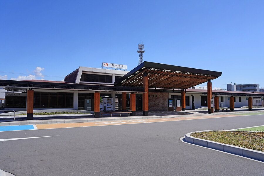
Eat and drink in Komagane town
Komagane is a small town of 30,000 in the Tenryu River valley, and it has a proud food scene that punches well above its size. The local speciality is sauce-katsu-don, a deep-fried pork cutlet on rice with a sweet-soy sauce that is poured over the cutlet rather than under it. Komagane and Iida claim to have invented the dish in the 1920s. The classic shop is Viande Sakura-tei, a 7-minute walk from the highway bus stop, with a cutlet-and-rice set around ¥1,500. It also doubles as the boarding stop for the local Komagane Sun-Sun Bus, which is a useful loop for non-drivers.
Komagane is also an alcohol town. The water from the Central Alps feeds Mars Komagane Distillery (one of Japan’s small whisky distilleries, with a tasting room and free factory tour), the Minami-Shinshu Beer brewery, the Mars Wine winery, and a craft gin distillery at Kurasawa-no-Mori. If you have a half-day at the bottom of the cirque before or after the ropeway, the Sun-Sun Bus loops these for ¥500 a ride or ¥1,500 for a one-day pass. You cannot drive in Japan with any alcohol in your system, and the Sun-Sun Bus is the practical workaround.
The wider Central Alps view, from the cirque
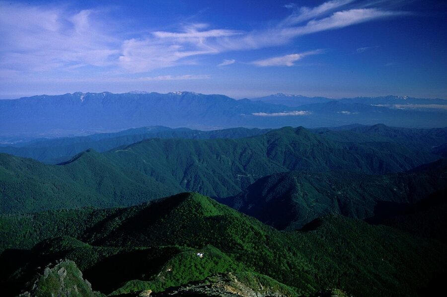
The Central Alps run roughly 100km north to south and 20km east to west. They are bookended by Mt Kiso-Komagatake (2,956m) at the northern end and Mt Ena (2,191m) at the southern end. Between them is a high-ridge spine that drops below 2,500m only twice. None of the named peaks reach 3,000m. The range was uplifted by reverse faulting in the same Quaternary tectonic phase that pushed up the Northern and Southern Alps, but on a smaller scale. The granite is exposed almost everywhere, and the cirques (there are several besides Senjojiki) are unusually well-preserved for their elevation.

From the Kiso-Komagatake summit on a clear day you can see Mt Fuji to the south-east, the Yatsugatake range due east, the Northern Alps north (Yari, Hotaka, Tateyama all visible if the air is dry), and the Southern Alps to the south. It is one of the broadest 360-degree views of any Japanese summit, partly because the Central Alps stand alone in the middle of Honshu without a higher range nearby to block the view.
Combining Senjojiki with the rest of your trip
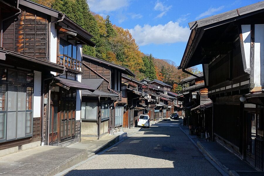
The natural pairing is with the Kiso Valley post-towns. Magome and Tsumago, the two preserved Edo-period stops on the old Nakasendo road, sit on the western side of the Central Alps and are reached from Komagane via the Chuo Line at Nagiso or Nakatsugawa. A Magome-Tsumago walking day on Tuesday and a Senjojiki ropeway day on Wednesday is one of the cleanest two-day pairs in central Japan. Read our access guide for the rail logistics.
Senjojiki also slots into the longer Japan Alps loop. Most multi-day itineraries through central Honshu start at Matsumoto, head north to Kamikochi or Hakuba, and skip the Central Alps entirely. That is the gap to fill. A Matsumoto base lets you do a Kamikochi day trip on day one, a Senjojiki day trip on day two, and a Magome-Tsumago walk on day three, all from the same hotel. Our Japan Alps itineraries page has more on this kind of routing.
Practical: when to skip Senjojiki
I am pro-Senjojiki, but it is not a fit for every visit. Days when you should consider skipping it.
If the forecast is rain or low cloud, skip. The cirque-floor loop is a wet stone staircase in rain, and the views are obscured. The mountain weather can change inside a 30-minute ropeway ride. Check the live cam at chuo-alps.com before you commit, and if there is no visibility on Mt Hoken, save the trip for another day.
If you are squeezing the visit into a single day from Tokyo with no flex, skip. The Saturday morning peak-autumn queue alone can blow a tight schedule, and the bus-plus-ropeway round trip is 4 hours of transit each way. A weekday or an overnight near Komagane is a far better experience.
If you are altitude-sensitive and have not gone above 2,000m before in your life, plan a slower visit. Take the ropeway up, walk slowly on the cirque-floor loop, eat lunch at Hotel Senjojiki, take the ropeway back down. Do not attempt Hatchozaka on a same-day plan unless you have alpine experience.
What to bring
For the cirque-floor loop only: closed walking shoes, a windproof layer over a long-sleeve top, sunglasses, sun hat, sunscreen, water. Even in August, the wind in the cirque can drop the felt temperature to single digits. The summer high is around 20 degrees and the average is 11 to 12 degrees, with cold mornings and evenings. UV is high.
For the Mt Hokendake or Mt Kiso-Komagatake summit: full hiking boots with ankle support, trekking poles, full waterproof set (the cloud comes in fast), gloves even in summer for the chained sections, headlamp if you might be late getting back, a litre of water minimum, a calorie-dense snack. Crampons and an axe are required from late October through May. Rentals are not available at the cirque.
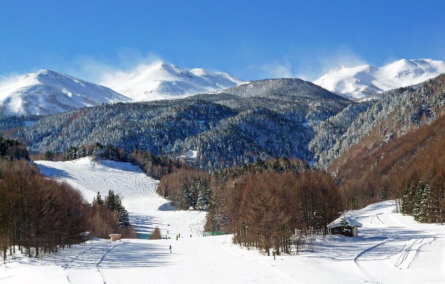
Winter at Senjojiki
The ropeway runs year-round. Winter is the most dramatic season at Senjojiki, with the cirque buried under three to five metres of snow, the air dry and crystalline, and the cabin from Shirabidaira passing through a near-vertical white wall on the way up. Average daytime temperatures from December to February are around minus 10 degrees, with overnight lows below minus 20.
The cirque-floor loop is closed in winter. You can walk a short distance from the ropeway top station onto the snow, and you can use Hotel Senjojiki and its restaurant, but the proper hiking is for experienced winter alpinists with crampons, ice axe, and avalanche kit. The summit hikes are full winter routes from December through April, and Hokendake’s chains are buried under ice. Plenty of climbers do them. They are not casual day hikes.
Sister destinations on this site
If Senjojiki is part of a longer Japan Alps trip, the natural cluster is the high-altitude entries that share its altitude profile. Read our how to book a Japan Alps mountain hut guide before you stay anywhere over 2,500m. The altitude sickness guide is one of our most-read pieces and applies directly to a Senjojiki visit. The skiing guide covers the spring backcountry option here and the wider winter resorts. The access guide spells out the rail and bus logistics from every direction. And the itineraries page shows how to thread Senjojiki into 5, 7 and 10-day Japan Alps loops.
One last thing
The first time I came up to Senjojiki, I made the mistake of trying to summit Kiso-Komagatake the same morning I arrived. I had been at sea level the night before, took the early bus, hit the ropeway by 9 a.m., and was on Hatchozaka by 10. By the time I reached Norikoshi Jodo my head was pounding so hard I could not focus on the ridge in front of me. I sat in the lee of Hokendake-sanso for an hour drinking water, then turned around and went back down. I was furious with myself for wasting the day.
That is the lesson. The ropeway is so fast, and the cirque so accessible, that it is easy to forget you have just arrived in the alpine zone. Spend an hour at the cirque floor first. Drink twice as much water as you think you need. Then, if you still want to climb, climb. Senjojiki rewards a slow visit and punishes a rushed one.