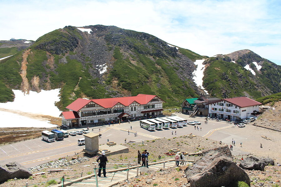
Two thousand seven hundred and two metres. That’s the altitude of the bus terminal at Tatamidaira, the end of the line on Mount Norikura. There’s no funicular, no rope-way, no tourist train climbing through tunnels. A diesel bus runs you from a quiet onsen village at 1,500m up to the third-highest peak you can reach in Japan without putting boots on a trail. It’s a strange piece of Japan Alps engineering, and it’s the reason most people end up in Norikura Kogen in the first place.
But the village at the base, the onsen plateau called Norikura Kogen, is the part most foreign guides skim past. Japan-guide.com gives it five lines and a forum thread. The Japanese tourism association gives it 30,000 words of seasonal walks, ryokan profiles, and waterfall diaries. Worth working out which version is right.
In This Article
- Norikura Kogen vs Mount Norikura: get the names straight first
- Getting there: it’s a train, then a bus, then another bus
- The shuttle to Tatamidaira: private cars are banned, year-round
- The summit: walkable in trainers if the weather is kind
- The longer climb from Suzuran Bridge
- The plateau walks: three waterfalls, two ponds, and a meadow
- Zengoro Falls: the easy one
- Sanbondaki: three falls in one frame
- Bandokoro Otaki: the dramatic one
- Ushidome Pond and Maime Pond: still water reflections
- Ichinose Meadow: the long flat one
- Onsen: three sources, one milky-white neighbour
- Skiing at Norikura: small, quiet, deep snow
- Where to stay: the village layout matters
- When to come: four genuine seasons
- Spring (late April – early June)
- Summer (mid-July – late August)
- Autumn (mid-September – late October)
- Winter (December – March)
- What to combine it with
- Practical notes
Norikura Kogen vs Mount Norikura: get the names straight first
This trips up almost everyone who arrives. Two different places share the name.
Norikura Kogen (乗鞍高原) is the plateau on the Nagano side. Altitude 1,200 to 1,800m, with the village clustered around 1,500m. About 80 inns and pensions, three onsen sources, a ski resort, a network of forest walks, and three of Japan’s hundred best waterfalls. This is the base, the place you sleep, eat, and start the next day from.
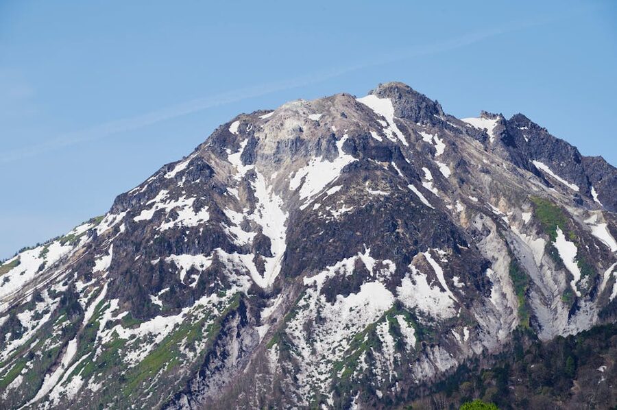
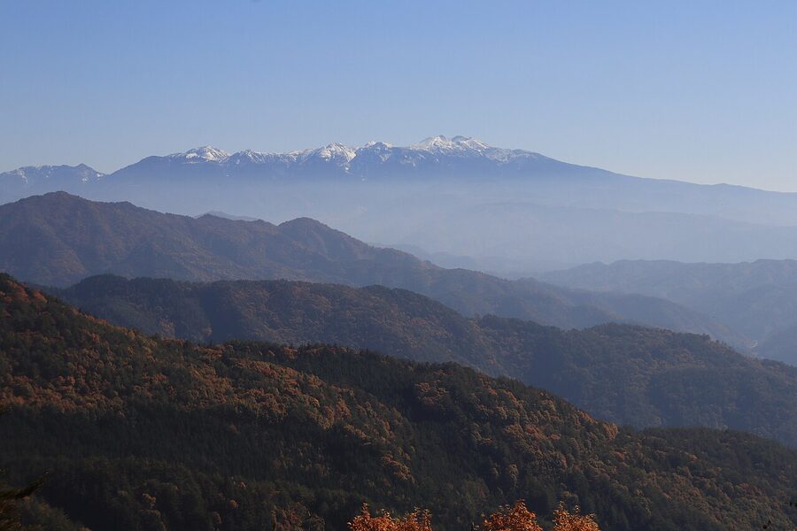
Mount Norikura (乗鞍岳, Norikura-dake) is the volcano above it. The southernmost peak of the Northern Japan Alps and one of the Hyakumeizan, Japan’s hundred famous mountains. The mountain is technically a complex of 23 peaks and seven crater lakes; the highest of them, Kenga-mine, is 3,026m. It last erupted around 43,000 years ago, which is why the plateau below sits on a lava bench full of ponds.
You can do one without the other. A lot of foreign visitors only go up to Tatamidaira and ride straight back down, skipping the village entirely. That’s the cheap way to tick a 3,000m peak off the list, but it misses the better half of the trip. The ryokan, the night-sky walks, the milky water of Shirahone – they’re all in the village, not the summit.
Getting there: it’s a train, then a bus, then another bus
From Matsumoto, the chain runs:
- Matsumoto Station to Shin-Shimashima: 30 minutes, ¥710, on the Alpico Kamikochi Line. This is a private regional railway, so your IC card (Suica, ICOCA) doesn’t work. Buy a paper ticket at the station.
- Shin-Shimashima to Norikura Kanko Center: 50 minutes, ¥1,350, on the Alpico bus. Buy a return-to-Matsumoto combo ticket for ¥3,300 if you can – it saves you about ¥110 and you don’t need to buy bus tickets for the way back.
From Takayama on the Gifu side, you don’t actually go to Norikura Kogen – the village is on the Nagano side and the mountain road between the two halves is permanently shut to vehicles. Takayama traffic ends up at the Norikura Skyline gate or at Hirayu Onsen. If you’re staying in Takayama and want the village, plan to come over Abo Pass via Matsumoto. It’s annoying but unavoidable.
Driving to the village itself is fine. There’s a free car park at the visitor centre and another at Mt Norikura Information Centre next to the bus terminal. Just don’t expect to drive up the mountain – see the next section.
For the broader regional context, the Japan Alps access guide lays out which station hub serves which mountain and where the IC card frontier is.
The shuttle to Tatamidaira: private cars are banned, year-round
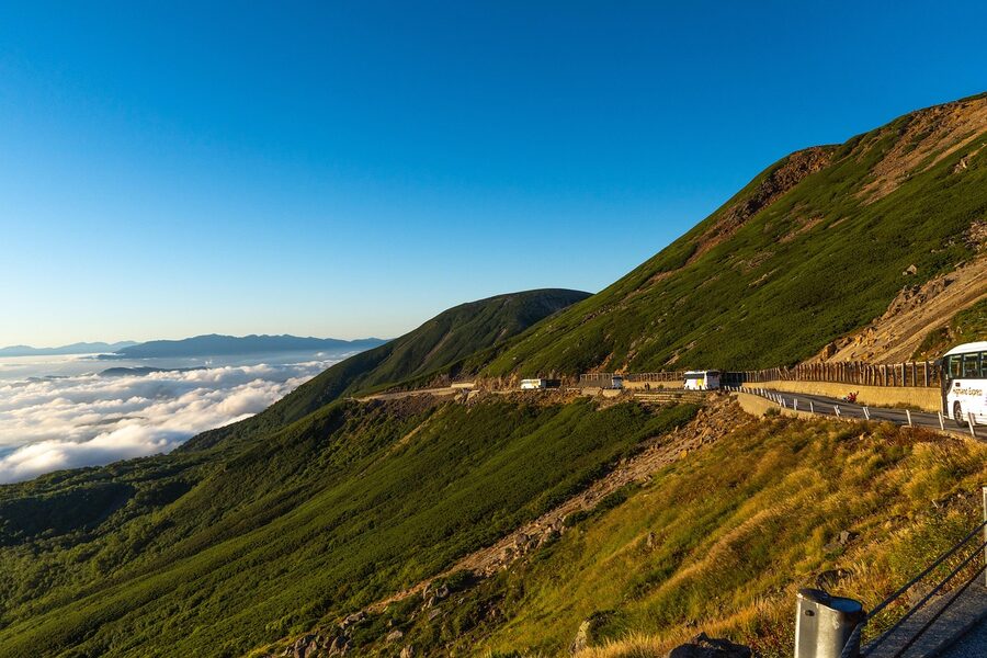
This is the headline rule: you can’t drive up Norikura. Both the Norikura Echo Line on the Nagano side and the Norikura Skyline on the Gifu side are closed to private vehicles permanently. The road exists, but it’s bus and bicycle only.
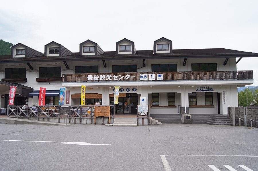
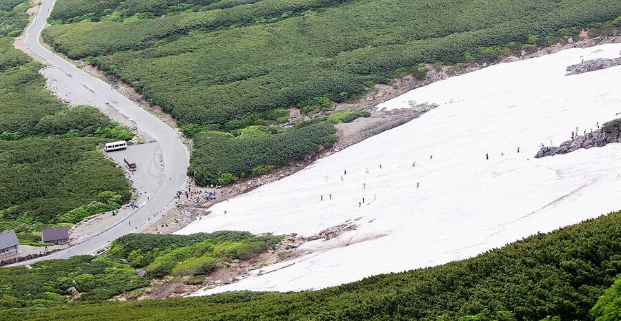
The summer summit shuttle from Norikura Kanko Center runs 1 July through 31 October. It leaves every one to two hours, takes 50 minutes to climb to Tatamidaira, and costs ¥1,650 one way. Advance booking is required, especially in peak season – Obon week in mid-August and the autumn colour weekends in late September can sell out a day in advance. Book through Alpico’s website.
Outside that summer window there’s a different bus called the haruyama bus (春山バス, “spring mountain bus”). It starts running around 27 April every year, but only as far as Iga-hara Sansou at 2,350m – the road above is still buried. From early June it extends to the Daisekkei (大雪渓, “great snowfield”) stop at 2,614m, and only from 1 July does the full route to Tatamidaira open. So if you’re arriving in May, you can still get up the mountain – you just don’t reach the summit. Snow walls along the road still hit five metres in places.
The Skyline side from Hirayu Onsen and Hounokidaira opens in mid-May and runs through late October on roughly the same hours. Gates open at 6:00 from July through September, 7:00 the rest of the season.
Bring layers. The temperature drop from the village to Tatamidaira is brutal – at 1,500m a clear summer morning is a pleasant 18°C. At 2,702m on the same morning you’re in 8°C with a wind. People in T-shirts at the base regret it within ten minutes of stepping off the bus.
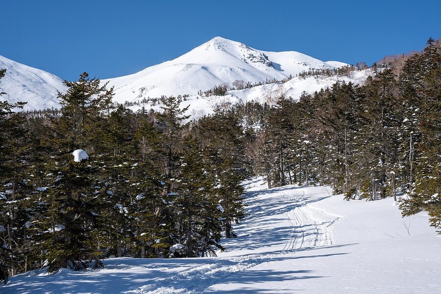
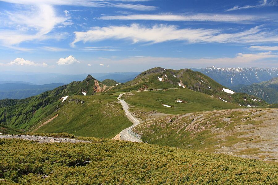
The summit: walkable in trainers if the weather is kind
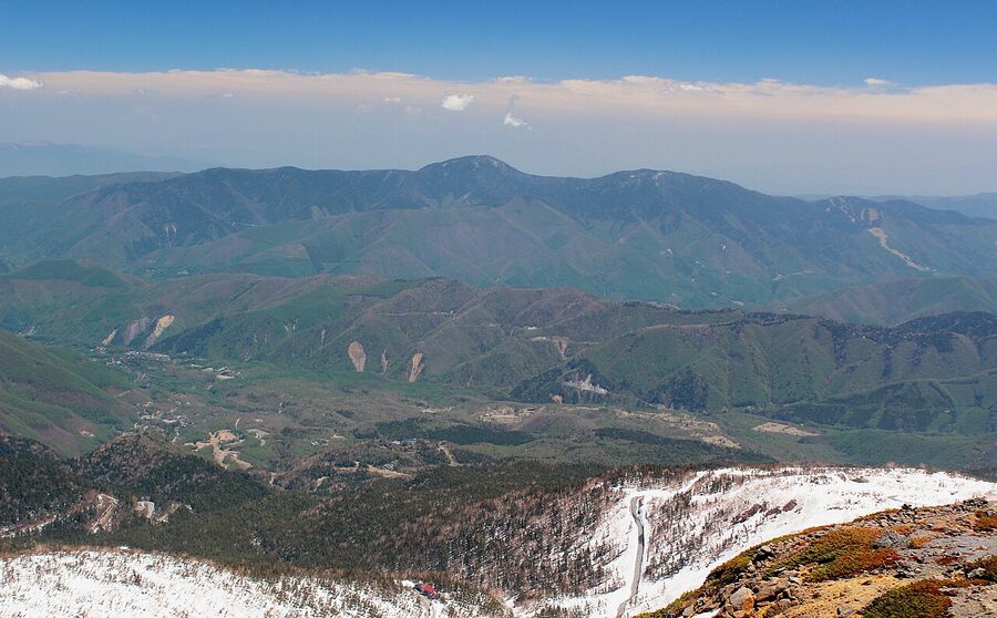
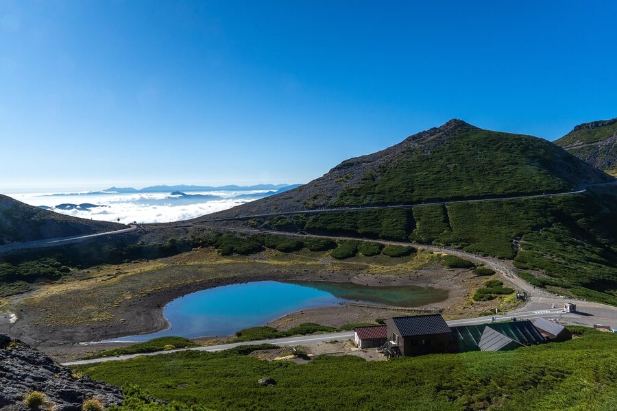
From Tatamidaira, the path to Kenga-mine (3,026m) takes about an hour and a half up, an hour back down. It’s marked, the gradient is moderate, and you don’t need crampons after late July. The route runs past the volcanic lake of Tsuruga-ike, through hai-matsu (creeping pine) zones, up to a stone shelter called Kata-no-koya, and then onto a rocky ridge to the summit. There’s a small shrine and a torii at the top.
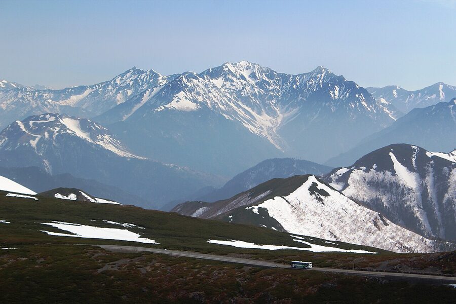
If the weather is genuinely good, the summit pays out. Yari-ga-take and the Hotaka range stretch north. The Southern Alps and the Central Alps line up on the eastern horizon. Mt Fuji shows up clearly on dry winter mornings – less so in summer haze. There’s a lower peak called Fujimi-dake (2,817m) on the way that earns its name.
The standard mistake is leaving Tatamidaira after lunch. Afternoon clouds boil up the eastern face every summer day, and a clear morning summit becomes a featureless white-out by 13:00. If you want the view, take the first bus from the village.
Anyone going above 2,500m without acclimatisation should read the altitude sickness guide first – Norikura is mild compared to Tateyama, but the jump from sea level to 3,026m in a few hours catches plenty of people. Sleep at 1,500m the night before and you’ll be fine.
The longer climb from Suzuran Bridge
If you actually want to climb Norikura – not just be delivered to the top – start from Suzuran Bridge in the village (1,512m) and walk up. The classic route through Hiyamizu-koya (2,230m) and Kurai-ga-hara-sanso (2,350m) joins the Tatamidaira trail at Kata-no-koya kuchi. Total: 11km, 1,530m of vertical, six hours forty-five minutes up. Most people break this with a night at one of the federation huts.
This is properly mountain country. The route is fine for fit hikers in good weather, but you’ll want boots, layers, water, and the understanding that the lower forest is bear country – every trailhead in Norikura has bell stations where you ring twice before continuing.
The plateau walks: three waterfalls, two ponds, and a meadow
The plateau itself is essentially flat – a 1,500m bench of birch forest, marsh, and pasture left over from old logging and dairy use. There are roughly 35km of marked walking paths, ranging from 20-minute strolls to half-day loops. The four worth your time are below.
Zengoro Falls: the easy one
Zengoro-no-taki sits 700 metres south-west of the visitor centre and drops 21.5m into an 8m-wide bowl of black volcanic rock. The walk in is gentle, mostly boardwalk, and signposted from the main road. Fifteen minutes each way at a reasonable pace.
The trick with Zengoro is winter. The falls freeze deep blue from December through early March and become a snowshoeing destination. If you’ve never seen a frozen waterfall, this is one of the easiest in central Japan to reach – a regular plough keeps the road open, and the snowshoe rental at the visitor centre runs ¥1,500 a day.
Sanbondaki: three falls in one frame
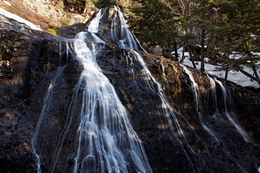
The Three Falls is the most photographed thing in Norikura, and the only Japan Alps waterfall I know of that’s actually three falls flowing side by side from three different streams into the same basin. Drop heights run 50 to 60 metres. The Ministry of the Environment counts them as one entry on its Top 100 Waterfalls of Japan list.
Two ways in. The fast way: take the Sanbondaki Bus Stop bus from the visitor centre, then walk 25 minutes through forest to the viewing platform. The slow way: hike the full Sanbondaki Trail from the village (about 1.7km each way, an hour and a quarter round trip from the trailhead car park). Buddhist priests used to chant mantras here, and you can see why – there’s a particular kind of standing-still that the spray and noise force on you.
One catch: the bus runs infrequently and not at all in winter or early spring. Check the Norikura Tourist Association schedule before you set out.
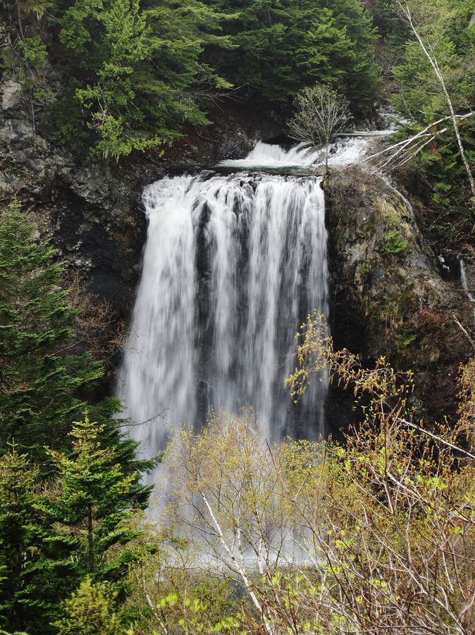
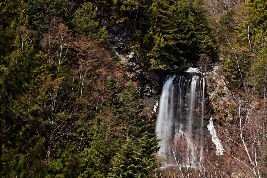
Bandokoro Otaki: the dramatic one
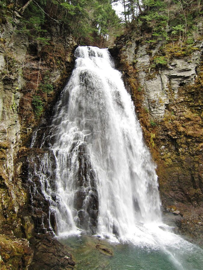
Bandokoro Otaki drops about 40m down a sheer face of black rock and feels bigger because of how compressed the canyon is. The viewpoint is reached by a short flight of stone steps from a dedicated car park. After you’ve stood at the deck, the 1.2km loop continues downstream past smaller falls and the dome-pool of Sengen-buchi.
This is the one to do when you only have an hour. The whole circuit takes about 60 minutes including stops, and the car park has clean toilets.
Ushidome Pond and Maime Pond: still water reflections
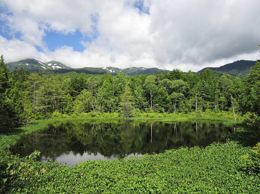
Ushidome-ike is a short boardwalk from the ski resort base, surrounded by cedar and a stand of nemagari-matsu (creeping pine bent by snow weight). The pond is shallow, completely still on calm mornings, and the local photography crowd shows up before sunrise for the inverted-mountain reflection.
If you only have time for one pond, make it Ushidome. If you have time for two, Maime-no-ike on the far side of Ichinose Meadow is the prettier shot – it’s part of the Ichinose loop trail and most people miss it because they bus straight to the summit.
Ichinose Meadow: the long flat one
The Ichinose loop is an 8km circuit through a flat meadow of white birch, ferns, ponds, and wild flowers. The terrain is genuinely level – fine for kids, fine for unfit visitors, fine for a slow afternoon. Allow two hours from the Ichinose car park, three hours from the visitor centre.
The meadow has two strong seasons. Mid-May to early June, the marshy patches fill with mizu-basho (Asian skunk cabbage) and the orange Japanese azaleas come up by mid-June. Mid to late October the birch turns yellow and the larches gold against the early snow on Norikura’s flanks. In winter, this is where the cross-country ski crowd goes.
One under-marketed thing: Ichinose at night is one of the best stargazing spots in Honshu. No light pollution, 1,500m altitude, and a ridge that blocks the lights from Matsumoto. There’s a stargazing tour run out of the village in summer and autumn.
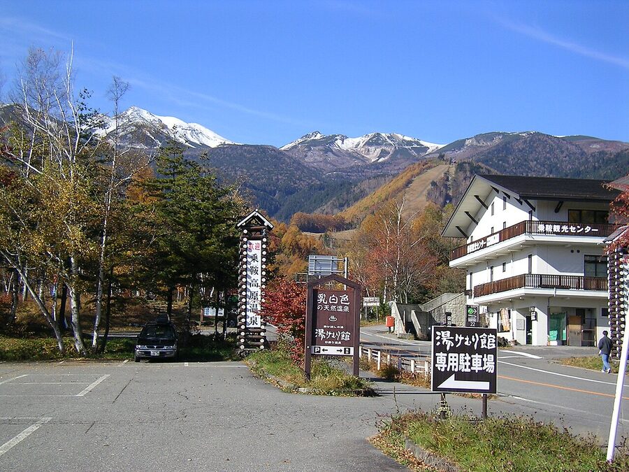
Onsen: three sources, one milky-white neighbour
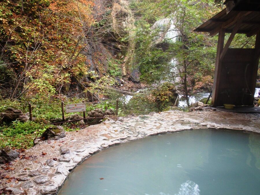
Norikura Kogen has three different hot spring sources serving the village: Suzuran-onsen, Norikura-onsen, and Azumino-Norikura-onsen. The water at each runs at different mineral mixes, but most ryokan plumb in only one. If you want to bath-hop, the village’s pass system covers four day-bath inns for around ¥1,500.
The famous neighbour is Shirahone Onsen, 30 minutes by bus from the visitor centre. The water there comes out clear and turns milky-white on contact with air – it’s a calcium-bicarbonate precipitate that the locals say “cures three days of sickness in one bath.” The communal outdoor pool (Yatate-no-yu kyoudou rotenburo) is ¥520 and worth the bus ride. If you want to stay over, the historic ryokan Awanoyu has been running its mixed-bath onsen since the late Edo period.
For the broader picture of Japan Alps onsen culture, the onsen guide covers tattoo policy, pricing patterns, and which valleys are worth a soak.
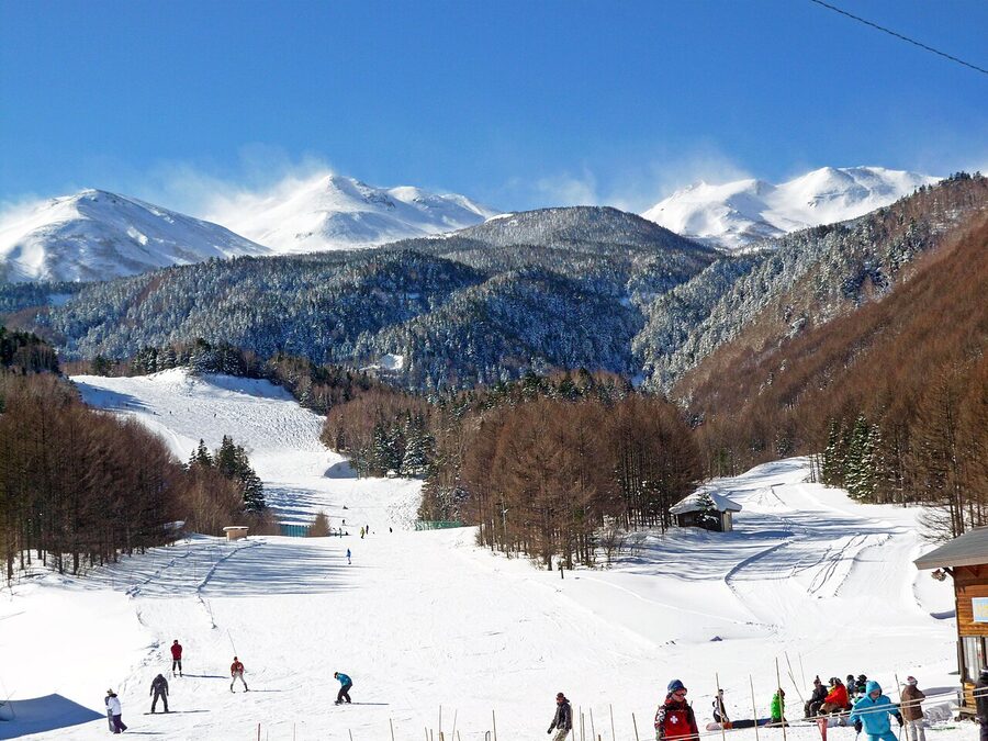
Skiing at Norikura: small, quiet, deep snow
Norikura Onsen Snow Resort (recently rebranded “Blue Resort Norikura”) is included on the Hakuba Valley pass, which means it’s technically a Hakuba resort even though it’s a 90-minute drive from Hakuba village proper. Don’t expect anything like Goryu or Happo One. It’s small. It’s quiet. The lift queues are essentially zero, and that’s the point.
The numbers: 14 trails, 500m of vertical (1,300m to 800m base). About 80% of the terrain is rated beginner or intermediate. The connection to Hakuba Cortina at the top adds 16 more runs, including the steeper black trails that Norikura itself lacks. The signature is widely-spaced birch trees on the lower slopes, perfect for an intermediate’s first taste of tree skiing without the consequences of a steep face.
What you trade for the quiet: limited freestyle terrain (one half-pipe, a basic boardercross), a thin lineup of base-area restaurants, and the fact that nothing here is open in English. If you’re a beginner who wants empty pistes and reliable snow, it’s better than the bigger Hakuba resorts. If you want après-ski, go elsewhere.
The neighbouring backcountry route between Cortina and Norikura is the actual draw for advanced skiers. Lap it from the Cortina lifts and finish at Norikura’s onsen for a soak.
Read the Japan Alps skiing guide for how Norikura sits against Hakuba, Otari, and the rest of the central Honshu ski belt.
Where to stay: the village layout matters
There are roughly 80 places to sleep in Norikura Kogen, ranging from federation mountain huts to family pensions to a couple of proper ryokan. The map breaks into four clusters:
- Around the Norikura Kanko Center – the most convenient base, walking distance to bus terminal, restaurants, and the trail network. Where most foreign visitors stay.
- Ski-base lodges – at the foot of the chairlifts. Excellent in winter, less convenient in summer because you’re far from the eastern walks.
- Suzuran-onsen / Ichinose hamlet – quieter, closer to the Ichinose meadow trailhead, but you’ll want a car or be willing to walk 30 minutes to anything.
- Mountain huts on Norikura itself – Kata-no-koya at 2,800m, Hiyamizu-koya, Kurai-ga-hara-sanso. For traverse hikers only.
For ryokan-style stays, Kyukamura Norikura-Kogen is the easy pick – large, government-run, includes onsen and a kaiseki dinner around the ¥18,000 mark per person. Yamabiko-so is a smaller pension with English-speaking owners and a quieter atmosphere. Senzan is older-style ryokan with a mixed-bath onsen.
For booking, check rates on Booking.com or Agoda. Most of the smaller pensions don’t appear on Western booking sites – call them directly through the Norikura Tourist Association if you’re after something specific.
When to come: four genuine seasons
Norikura works year-round, but each season is a different trip. Treat them as four separate visits.
Spring (late April – early June)
The shoulder. Mizu-basho cabbage starts blooming mid-April in the lower marshes, peaks during Golden Week (29 April – 5 May) at Ichinose, Ushidome, and Miyanohara. The plum-and-pear blossom comes a week later – locals throw the Sumomo Festival in mid-May to mark the opening of green season. The mountain road has been closed all winter; the spring mountain bus from 27 April lets you climb as far as 2,350m and walk along five-metre snow walls. You can’t summit yet (too much snow above 2,800m) but you can ski the Daisekkei snowfield from late May.
Summer (mid-July – late August)
The full mountain opens. Tatamidaira shuttle runs to the top, alpine flowers peak between mid-July and mid-August (komakusa, ezodake-fuuro, mizugiku), and the village is the coolest place in central Honshu – daytime highs around 25°C while Tokyo bakes at 35. This is when the summit walk to Kenga-mine is at its easiest. Book accommodation 4-6 weeks ahead for Obon week (around 13-16 August).
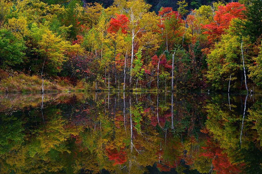
Autumn (mid-September – late October)
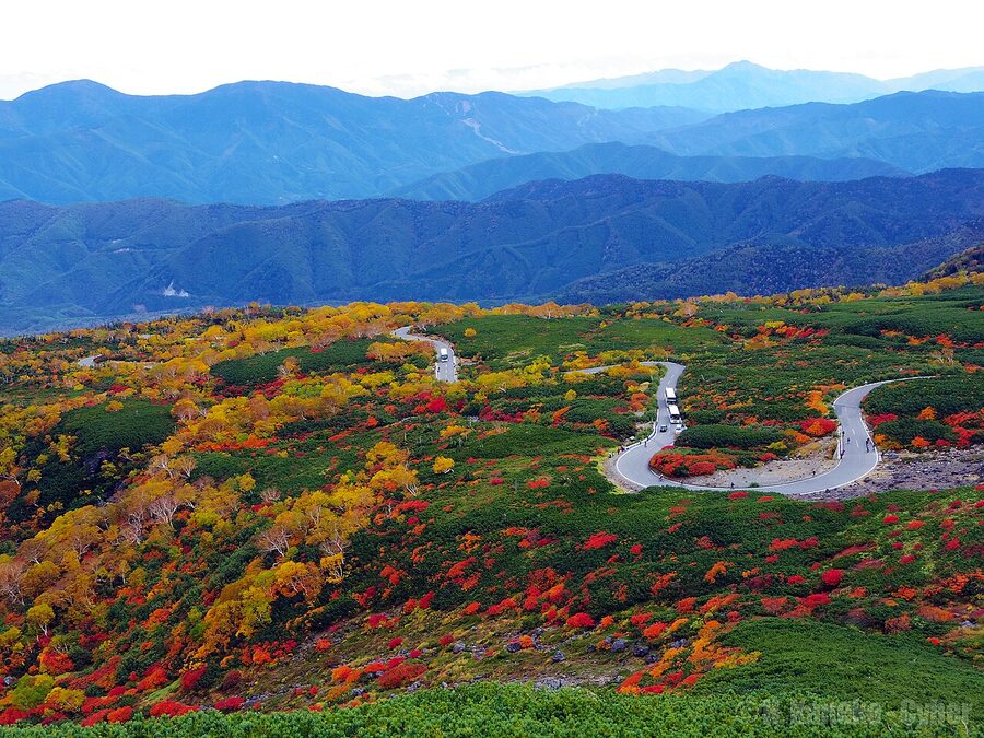
The smartest time to come if you can choose. The high alpine zone above 2,500m turns red and gold from mid-September; the larches at the village level peak in mid-to-late October. Cooler, less crowded, and the air is clear enough that the summit views actually deliver. The shuttle runs through 31 October.
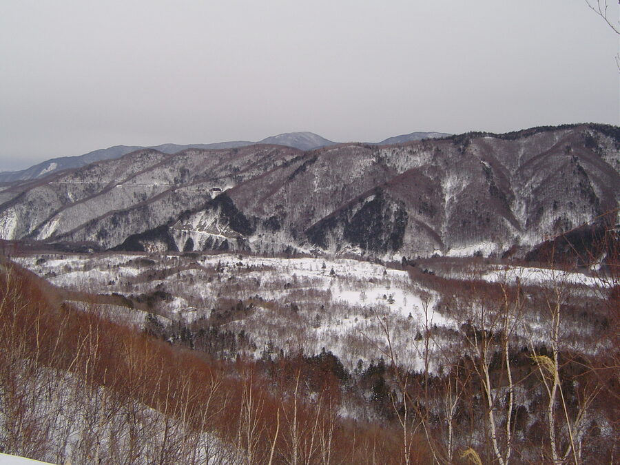
Winter (December – March)
The summit road shuts at the start of November. The village goes quiet, the ski resort opens, and Zengoro Falls and Sanbondaki freeze solid. Snowshoe rental at the visitor centre is ¥1,500 a day, and the Ichinose meadow becomes a cross-country track. Powder days are deep – central Honshu’s snow belt sits exactly here. Bring everything for the cold; village minimums hit -15°C in January.
What to combine it with
Norikura is awkward as a one-day trip from Tokyo – the train-bus-bus chain eats four hours each way – but it slots into a Japan Alps loop comfortably.
The natural pair is Kamikochi, a 90-minute bus or hire-car drive away through Sawando. Both are inside Chubu-Sangaku National Park, both are former tourist circuits dating to the 1920s. Kamikochi is busier and feels like a national park. Norikura is quieter and feels like a village. Two nights in each is comfortable.
From the south, Matsumoto is your obvious base – see the castle, eat the soba, then bus up to Norikura for a few days of mountain air. The reverse direction works too: spend three nights in Norikura, descend to Matsumoto for the city food and a black-castle morning, then move on.
Over the Skyline (or, in practice, around it via Hirayu) lies Takayama. The Hida-side onsen at Hirayu and Shin-Hotaka feel like a different country to Norikura, despite being 20km away by crow. If you’ve got a JR Tourist Pass for the Takayama Hokuriku route, this is the easy way to integrate Norikura into a Tokyo–Takayama–Kanazawa loop.
For the longer view, the Japan Alps itineraries page maps out 5, 7, and 10-day combinations that include Norikura as either a destination in its own right or a one-night stopover.
Practical notes
Cash is non-optional. Most of the smaller pensions, almost all of the cafes, and the snowshoe rental at the visitor centre take cash only. There’s an ATM in the visitor centre and another at the JA bank in the village – do not assume anything else accepts cards.
Mobile signal is patchy. Docomo and au cover the village reliably; Softbank drops out beyond Ichinose. The summit shuttle has signal at Tatamidaira but not on the way up. Download offline maps before you leave Matsumoto.
Bears are real. Black bears are active across the plateau April through November. Every official trailhead has a bell post; ring it twice and walk on. Bears are the reason for the late-spring trail closures the visitor centre announces, not snow. Don’t ignore the closure signs.
The Norikura Kogen Tourist Association office (the one inside the visitor centre) is where you sort out anything specific – current trail conditions, snowshoe rental, ryokan vacancies if you arrive without a booking, the pass for the public onsen. They run reasonable English. Walk in, don’t email.
The bus drivers know the place better than the maps. If you’re not sure which trail the snow has cleared on, ask the man at the wheel before he closes the door. He’ll tell you.